
Image: Map, Traverse des Sioux
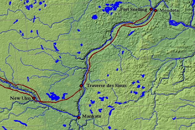
Description: Shaded relief image of south central Minnesota in central North America, from the National Atlas Mapmaker, modified to show location of Traverse des Sioux and Red River Trail along the Minnesota River, after Gilman, Rhoda et al., (1979) The Red River Trails 1820-1870, Saint Paul: Minnesota Historical Society Press, ISBN 0-8965-8036-9. As to modifications, submitter releases all rights and specifically licenses use of this image under GNU Free Documentation License.
Title: Map, Traverse des Sioux
Credit: http://www.nationalatlas.gov/natlas/
Author: self, using mapmaker tool of USGS, showing shaded relief, bodies of water, and county boundaries; the settlements, their names, and the trails were added by uploader, who releases into public domain any rights which the uploader has to those modifications of the base map
Usage Terms: Public domain
License: Public domain
Attribution Required?: No
Image usage
The following page links to this image:
