Traverse des Sioux facts for kids
Quick facts for kids |
|
|
Traverse des Sioux
|
|
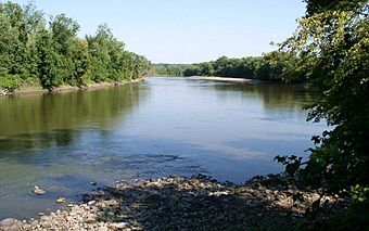
Minnesota River at Traverse des Sioux
|
|
| Location | Nicollet County, Minnesota |
|---|---|
| Nearest city | St. Peter, Minnesota |
| Built | 1851 |
| NRHP reference No. | 73000990 |
| Added to NRHP | March 20, 1973 |
Traverse des Sioux is a special historic place in Minnesota. It was once part of an old trade route. Today, it is protected to remember this busy river crossing. It also marks a settlement, a trading post, and a mission from the 1800s.
This spot was important for moving animal furs during the fur trade. It is also famous for a major treaty signed there. This treaty made the Dakota people give up a large part of their homeland. This opened up much of southern Minnesota for European-American settlers.
Traverse des Sioux was once a state park. Now, it is a State Historic Site and a Minnesota State Monument. It is listed on the National Register of Historic Places. You can find Traverse des Sioux on the Minnesota River in Nicollet County. It is just north of St. Peter. The river was a main travel route long ago. The exact spot of the old river crossing was found again in the early 2000s. It is marked with pipes because the river has changed its path.
Contents
What Does Traverse des Sioux Mean?
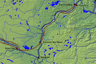
The word Traverse comes from French and means crossing. So, Traverse des Sioux means the "crossing of the Sioux." This name was used for two things. It meant crossing the Minnesota River at this spot. It also meant crossing the open prairie from the west.
French-Canadian travelers, called voyageurs, used the word traverse. Their relatives, the Métis people, also used it. A traverse was a safe journey from one resting place to another. This could be crossing dangerous waters or open land. The settlement at Traverse des Sioux was a stop for Métis ox cart trains. These carts traveled on the Red River Trails.
A famous explorer named John C. Frémont used the term Traverse des Sioux. He used it for crossing the plain west of the river. Travelers heading west would leave the river at Traverse des Sioux. They would go straight across the open prairie. This was a shortcut to avoid a big bend in the river near Mankato. They would meet the river again near New Ulm.
History of the Site
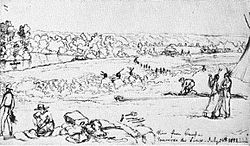
Native Americans used this river crossing for thousands of years. They used it long before Europeans arrived. A trading post likely existed here by the late 1700s. Many fur traders set up businesses here in the early 1800s. An Indian mission was also started here in 1843.
By the 1840s, this site was key for the fur trade. Animal furs from far away places like Pembina, North Dakota, arrived here. They came by ox cart trains on the West Plains Trail. At Traverse des Sioux, the furs were moved from carts to flatboats. These boats then carried the furs to Mendota, Minnesota and markets in the east. Later, some carts went all the way to Mendota or Saint Paul, Minnesota. From there, riverboats took the furs down the Mississippi River.
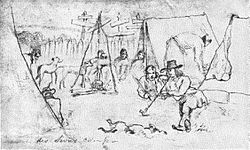
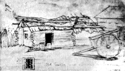
By 1851, the settlement was quite busy. It had two missionaries and their families. There was also a school and several fur trading posts. A few cabins belonged to French voyageurs. About twenty to thirty Native American lodges were also there.
The Treaty of Traverse des Sioux
In 1851, a very important agreement was signed here. It was called the Treaty of Traverse des Sioux. The United States government signed it with tribes of the Sioux people. The Dakota people agreed to give up 24 million acres of their land. In return, they were promised reservations and payments. They were paid about seven cents per acre.
This treaty opened up huge areas of Minnesota Territory for new settlers. The land given up included most of Minnesota west of the Mississippi River. It also included land in what is now South Dakota and northern Iowa.
After the treaty, a town was planned at this site. It kept the name Traverse des Sioux. The town grew to have seventy buildings. These included two hotels, several churches, and five taverns. However, the town lost its importance in 1856. The nearby city of Saint Peter became the new county seat for Nicollet County. By 1869, the old town of Traverse des Sioux was empty.
Protecting the Site
In 1905, a group was formed to find the exact spot where the 1851 treaty was signed. They found the location, and it was officially recognized in 1914. A park called Traverse des Sioux Treaty Site Park was created. However, not much was built there at first.
The park was changed to a state wayside park in 1937. This was during the Great Depression. The state tried to buy more land for the park. But these efforts stopped by 1963. The site was flooded badly in 1965 by the Minnesota and Mississippi rivers.
In 1969, the state allowed the historic site to grow. An investigation found the old foundations of the town. In 1980, the park and townsite were moved out of the state park system. They were given to the Minnesota Historical Society. Any extra land was given to the city of Saint Peter.
Today, you can take a self-guided tour of the old town and treaty site. The Nicollet County Historical Society has its main office nearby. It is at the Treaty Site History Center. They have exhibits about the treaty and local history. The county historical society manages the site with the Minnesota Historical Society.
In 2006, experts found the exact spot of the old river crossing. They used an old map from a book called Old Traverse des Sioux (1929). An engineer used this map to find the remains of the village. He combined old maps with new surveys. This helped locate the fur post, cemetery, and other parts of the old settlement. Also, archaeologists have found very old tools here. These tools are about 9,000 years old. This shows that Native Americans visited this site for many thousands of years. The ends of the old river crossing are now marked with PVC pipes. This is because the river has changed its path over time.
|
 | William L. Dawson |
 | W. E. B. Du Bois |
 | Harry Belafonte |


