
Image: Map-Prussia-EastPrussia

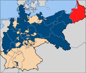
Description: The province of East Prussia (red), within the Kingdom of Prussia (blue).
Title: Map-Prussia-EastPrussia
Credit: Based on map data of the IEG-Maps project (Andreas Kunz, B. Johnen and Joachim Robert Moeschl: University of Mainz) - http://www.ieg-maps.uni-mainz.de
Author: User:52 Pickup
Permission: This file is licensed under the Creative Commons Attribution-Share Alike 2.5 Generic license. You are free: to share – to copy, distribute and transmit the work to remix – to adapt the work Under the following conditions: attribution – You must give appropriate credit, provide a link to the license, and indicate if changes were made. You may do so in any reasonable manner, but not in any way that suggests the licensor endorses you or your use. share alike – If you remix, transform, or build upon the material, you must distribute your contributions under the same or compatible license as the original.https://creativecommons.org/licenses/by-sa/2.5CC BY-SA 2.5 Creative Commons Attribution-Share Alike 2.5 truetrue
Usage Terms: Creative Commons Attribution-Share Alike 2.5
License: CC BY-SA 2.5
License Link: https://creativecommons.org/licenses/by-sa/2.5
Attribution Required?: Yes
Image usage
The following page links to this image:
