
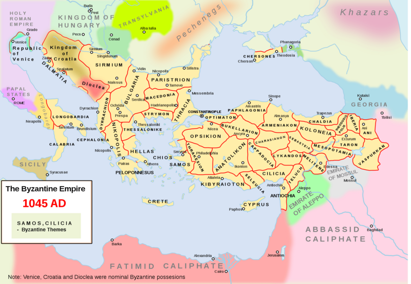
Image: Map Byzantine Empire 1045 2000px svg

Size of this preview: 800 × 554 pixels. Other resolutions: 320 × 222 pixels | 2,000 × 1,385 pixels.
Original image (2,000 × 1,385 pixels, file size: 1,000 KB, MIME type: image/png)
Description: The Byzantine empire and its neighbours in 1045. Byzantine administrative divisions included.
Title: Map Byzantine Empire 1045 2000px svg
Credit: en:File:Map Byzantine Empire 1045.svg *Transferred from en.wikipedia to Commons by Vammpi using CommonsHelper.
Author: Andrei nacu
Usage Terms: Public domain
License: Public domain
Attribution Required?: No
Image usage
The following 2 pages link to this image:

All content from Kiddle encyclopedia articles (including the article images and facts) can be freely used under Attribution-ShareAlike license, unless stated otherwise.