
Image: Map Canton Jura Bezirke

Size of this preview: 800 × 577 pixels. Other resolutions: 320 × 231 pixels | 885 × 638 pixels.
Original image (885 × 638 pixels, file size: 122 KB, MIME type: image/png)
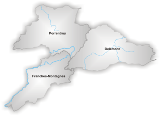
Description: Map of districts in Canton Jura drawn by Tschubby under GFDL
Title: Map Canton Jura Bezirke
Credit: Image Source: http://de.wikipedia.org/wiki/Bild:Karte_Kanton_Jura_Bezirke.png
Author: Artist: http://de.wikipedia.org/wiki/Benutzer:Tschubby
Usage Terms: Creative Commons Attribution-Share Alike 3.0
License: CC-BY-SA-3.0
License Link: http://creativecommons.org/licenses/by-sa/3.0/
Attribution Required?: Yes
Image usage
The following page links to this image:

All content from Kiddle encyclopedia articles (including the article images and facts) can be freely used under Attribution-ShareAlike license, unless stated otherwise.