
Image: Map Kampot Province

Size of this preview: 768 × 600 pixels. Other resolutions: 307 × 240 pixels | 841 × 657 pixels.
Original image (841 × 657 pixels, file size: 352 KB, MIME type: image/png)
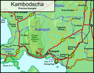
Description: Map of the Cambodian province Kampot
Title: Map Kampot Province
Credit: Own work - self drawn map own work based on data from Demis.nl
Author: Stefan Fussan
Usage Terms: Public domain
License: Public domain
Attribution Required?: No
Image usage
The following 2 pages link to this image:

All content from Kiddle encyclopedia articles (including the article images and facts) can be freely used under Attribution-ShareAlike license, unless stated otherwise.