Kampot Province facts for kids
Quick facts for kids
Kampot Province
ខេត្តកំពត
|
|
|---|---|
|
Province
|
|

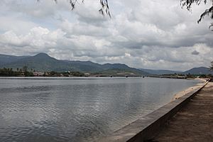
Teuk Chhou River
|
|

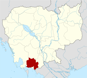
Map of Cambodia highlighting Kampot
|
|
| Country | |
| Provincial status | 20 August 1923 |
| Capital | Kampot |
| Area | |
| • Total | 4,873 km2 (1,881 sq mi) |
| Population
(2019 census)
|
|
| • Total | |
| • Density | 122/km2 (320/sq mi) |
| Time zone | UTC+7 (Cambodia) |
| Dialing code | +855 |
| ISO 3166 code | KH-7 |
| Districts | 8 |
| Communes | 92 |
| Villages | 477 |
Kampot is a beautiful province located in the southern part of Cambodia. It's known for its stunning natural beauty, including mountains, rivers, and a long coastline. The main city in the province is also called Kampot.
This area is famous for its special Kampot pepper. It's also home to a big national park. Many people visit Kampot to see its unique landscapes and learn about its history.
Contents
Discover Kampot Province
Kampot Province is a cool place to explore in Cambodia. It has a mix of nature, history, and delicious food. The province was officially made a province on August 20, 1923.
Where is Kampot Located?
Kampot Province is in the southern part of Cambodia. It has a coastline of about 45 kilometers (about 28 miles). This coastline is along the Gulf of Thailand. This means Kampot has lovely beaches and access to the sea.
What Makes Kampot Special?
Kampot is famous for a few things. One of the most well-known is Kampot pepper. This pepper is grown in the region and is known worldwide for its amazing flavor. It's often called one of the best peppers in the world!
The province also has beautiful natural areas. A big part of it is covered by Preah Monivong National Park. This park is a great place to see mountains and forests.
Mountains and Weather
The Dâmrei Mountains run through Kampot. These mountains get a lot of rain during the monsoon season. However, they also create a "rain shadow" effect. This means the eastern parts of the province get less rain.
The mountains are home to highland plateaus. These areas are part of the Phnom Bokor National Park. You can find unique plants and animals here.
Farms and Fishing
Because of its fertile land, Kampot has many farms. Besides pepper, farmers grow other crops too. Fishing is also a big part of life here. Many people in Kampot work as fishermen, catching seafood from the river and the sea.
Exploring Kampot's Districts
Kampot Province is divided into several areas called districts. These districts help manage the different parts of the province. There are 7 districts and 1 municipality (a city area) in Kampot.
- Angkor Chey
- Banteay Meas
- Chhouk
- Chum Kiri
- Dang Tong
- Kampong Trach
- Kampot Municipality
- Tuek Chhou
Things to See and Do
Kampot offers many fun activities for visitors. You can explore its natural beauty or learn about its history.
Cool Caves and Islands
There are interesting caves to visit in Kampot. One famous cave is Phnom Chhnork, which has an old temple inside. Another popular spot is the caves in Kampong Trach.
If you love beaches, Kampot has islands with sandy shores. Rabbit Island is a popular spot for relaxing and enjoying the sea.
Images for kids
-
Kampot pepper farm
See also
 In Spanish: Provincia de Kampot para niños
 | Kyle Baker |
 | Joseph Yoakum |
 | Laura Wheeler Waring |
 | Henry Ossawa Tanner |


