
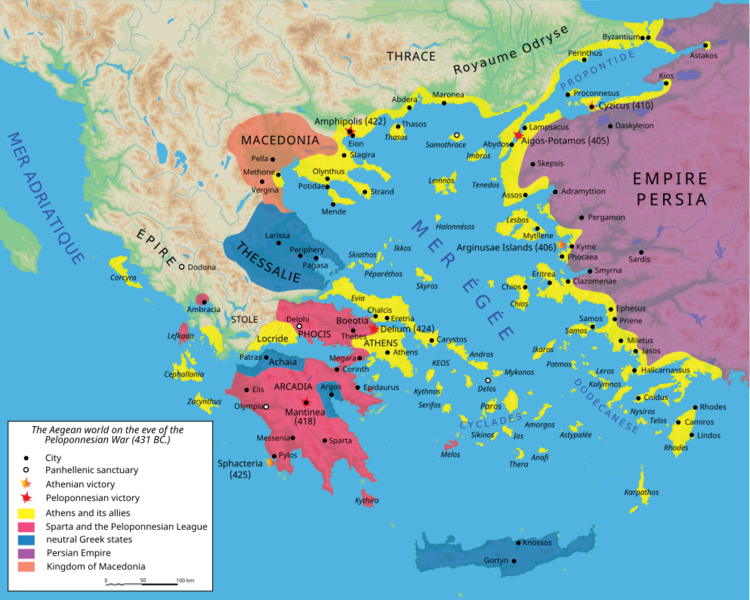
Image: Map Peloponnesian War 431 BC-en

Size of this PNG preview of this SVG file: 750 × 600 pixels. Other resolution: 300 × 240 pixels.
Original image (SVG file, nominally 993 × 794 pixels, file size: 2.97 MB)
Description: Map of the nations during the start of the Peloponnesian War around 431 BC.
Title: Map Peloponnesian War 431 BC-en
Credit: Map_Peloponnesian_War_431_BC-fr.svg (E. Lévy, La Grèce au Ve siècle, Paris, 1995)
Author: Map_Peloponnesian_War_431_BC-fr.svg: Marsyas derivative work: Aeonx (talk)
Usage Terms: Creative Commons Attribution-Share Alike 3.0
License: CC BY-SA 3.0
License Link: http://creativecommons.org/licenses/by-sa/3.0/
Attribution Required?: Yes
Image usage
The following page links to this image:

All content from Kiddle encyclopedia articles (including the article images and facts) can be freely used under Attribution-ShareAlike license, unless stated otherwise.