
Image: Map SLH-1650 EN
Size of this preview: 603 × 600 pixels. Other resolutions: 241 × 240 pixels | 900 × 895 pixels.
Original image (900 × 895 pixels, file size: 134 KB, MIME type: image/png)
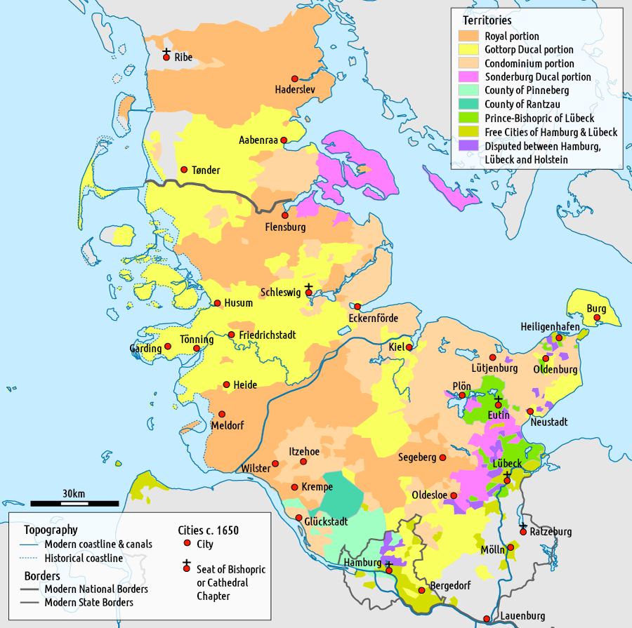
Description: Political map of Schleswig-Holstein around 1650, with different territories color-coded and notable cities marked
Title: Map SLH-1650 EN
Credit: Translated from File:Map SLH-1650.png
Author: Bryan Rutherford
Usage Terms: Creative Commons Attribution-Share Alike 4.0
License: CC BY-SA 4.0
License Link: https://creativecommons.org/licenses/by-sa/4.0
Attribution Required?: Yes
Image usage
The following page links to this image:

All content from Kiddle encyclopedia articles (including the article images and facts) can be freely used under Attribution-ShareAlike license, unless stated otherwise.