
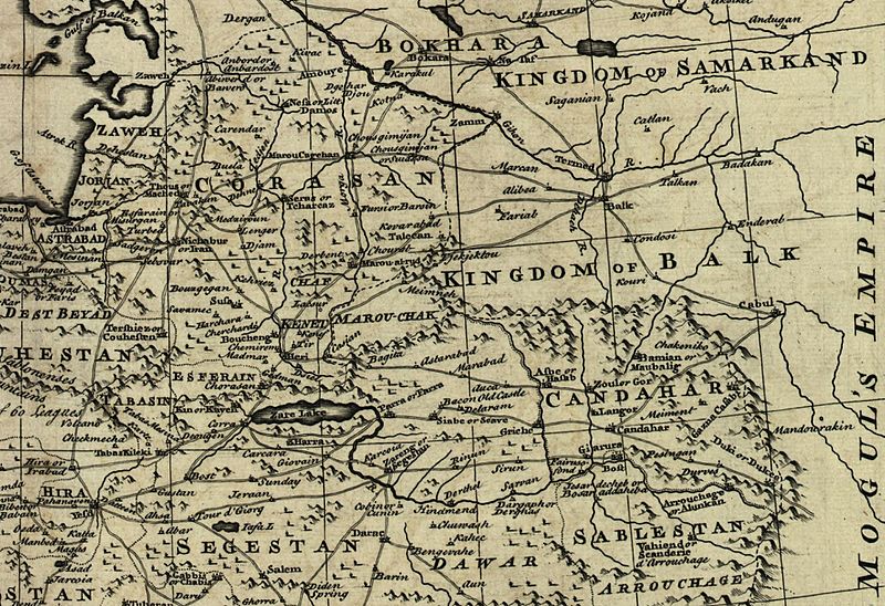
Image: Map of Afghanistan during the Safavid and Moghul Empire

Description: Map of Afghanistan during the Safavid and Mughal Empire, from the 16th century to 1747 when the current nation-state was created. Extracted from Bowen's A new & accurate map of Persia, with the adjacent countries.
Title: Map of Afghanistan during the Safavid and Moghul Empire
Credit: From: Bowen's A complete system of geography. London : Printed for W. Innys, R. Ware [etc.], 1747. Library of Congress Geography and Map Division, Call number G7620 1747 .B6 This map is available from the United States Library of Congress's Geography & Map Division under the digital ID g7620.ct001185. This tag does not indicate the copyright status of the attached work. A normal copyright tag is still required. See Commons:Licensing for more information. العربية | čeština | Deutsch | English | español | فارسی | suomi | français | magyar | italiano | македонски | മലയാളം | Nederlands | polski | português | русский | slovenčina | slovenščina | Türkçe | українська | 中文 | 中文(简体) | 中文(繁體) | +/−
Author: Bowen, Emanuel, d. 1767.
Usage Terms: Public domain
License: Public domain
Attribution Required?: No
Image usage
The following 3 pages link to this image:
