
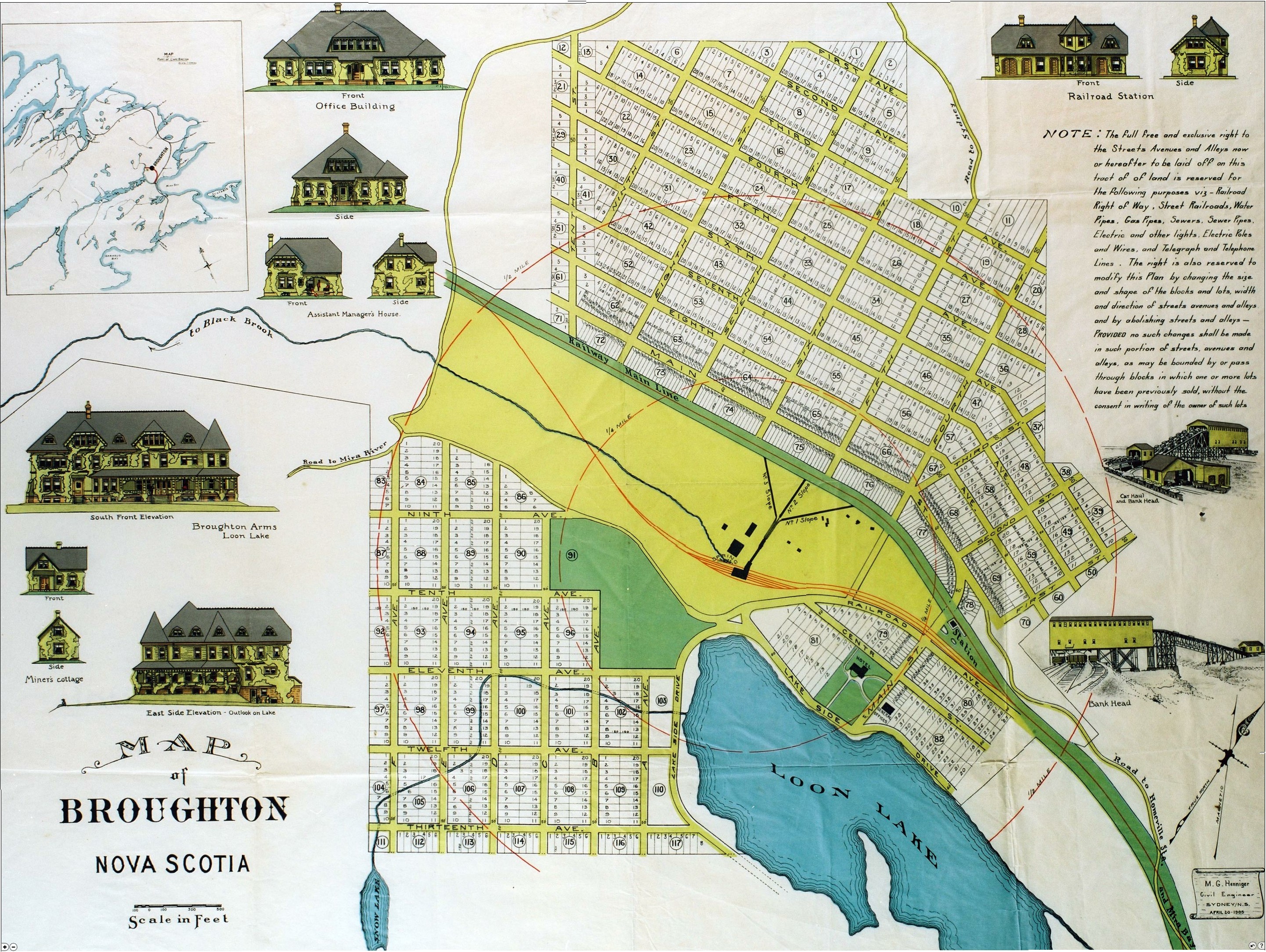
Image: Map of Broughton
Size of this preview: 797 × 600 pixels. Other resolutions: 319 × 240 pixels | 2,883 × 2,169 pixels.
Original image (2,883 × 2,169 pixels, file size: 1.89 MB, MIME type: image/jpeg)
Description: Map of town of Broughton, Nova Scotia, Canada. Map published in 1905 as per Nova Scotia archives. File Source: http://www.gov.ns.ca/nsarm/virtual/meninmines/exhibit.asp?ID=220&Language=English
Title: Map of Broughton
Usage Terms: Public domain
License: Public domain
Attribution Required?: No
Image usage
The following page links to this image:

All content from Kiddle encyclopedia articles (including the article images and facts) can be freely used under Attribution-ShareAlike license, unless stated otherwise.