
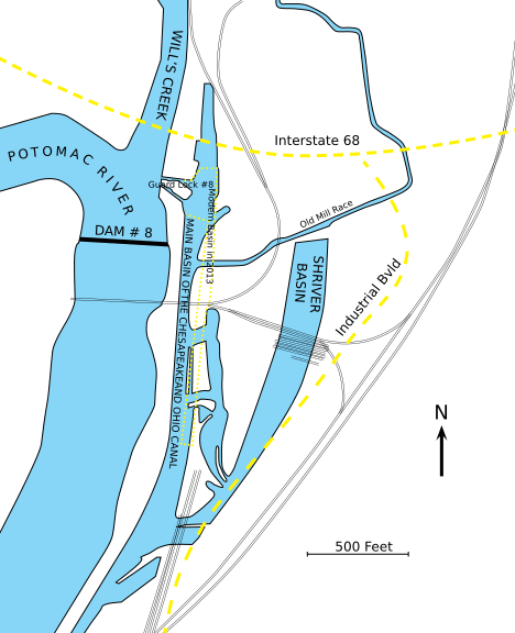
Image: Map of Chesapeake and Ohio Canal Terminus at Cumberland Maryland in mid 1890s

Size of this PNG preview of this SVG file: 468 × 576 pixels. Other resolution: 195 × 240 pixels.
Original image (SVG file, nominally 468 × 576 pixels, file size: 97 KB)
Description: Map of the end of the Chesapeake and Ohio Canal in the mid 1890's at Cumberland, Maryland. Yellow dotted lines indicate modern items, e.g. approximate location of Canal Basin in 2013, Interstate 68 and Industrial Bvld. Also note: some railroad tracks are missing, particularly the Western MD railroad, as well as the indications for the towpath.
Title: Map of Chesapeake and Ohio Canal Terminus at Cumberland Maryland in mid 1890s
Credit: Own work
Author: Bonnachoven
Usage Terms: Creative Commons Zero, Public Domain Dedication
License: CC0
License Link: http://creativecommons.org/publicdomain/zero/1.0/deed.en
Attribution Required?: No
Image usage
The following page links to this image:

All content from Kiddle encyclopedia articles (including the article images and facts) can be freely used under Attribution-ShareAlike license, unless stated otherwise.