
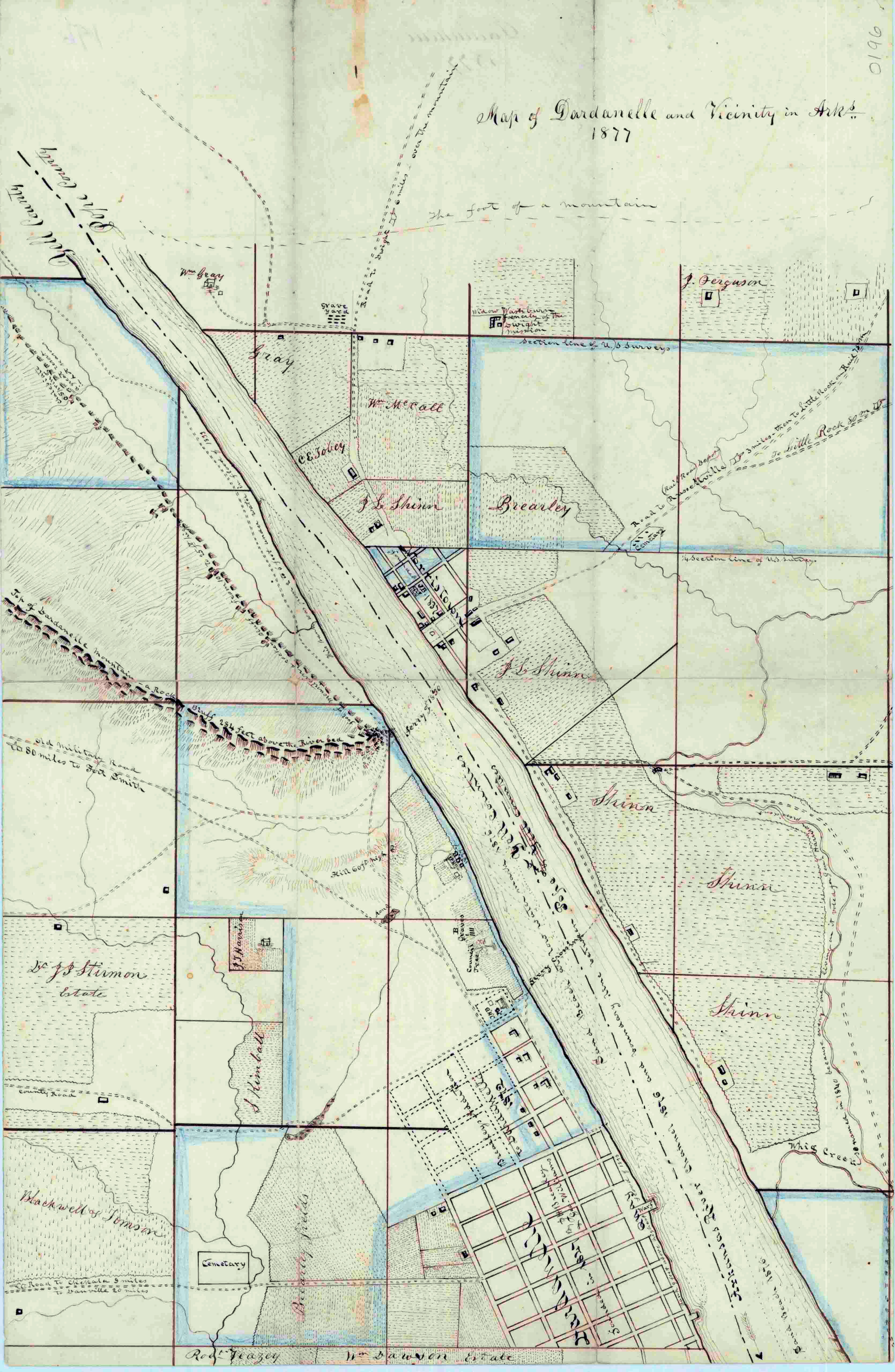
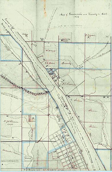
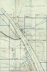
Image: Map of Dardanelle and Vicinity in Arks 1877
Description: 1877 colored, hand-drawn 11"x17" map of Dardanelle, Yell County, Arkansas and its vicinity, including Norristown in Pope County, showing the area as it was in 1876. The map shows the Pope and Yell County line, property owned by various local citizens and a partial town plat of Dardanelle. The map indicates that Dardanelle was founded in 1847 and Norristown in 1837. Map of Dardanelle and Vicinity, 1877, Map0196, Map collection, Arkansas State Archives, Little Rock, Arkansas Image restoration note – This image has been digitally adjusted for fade correction, and contrast/saturation enhancement.
Title: Map of Dardanelle and Vicinity in Arks 1877
Credit: https://www.flickr.com/photos/exit78/51958918179/
Author: Mike Goad
Usage Terms: Creative Commons Zero, Public Domain Dedication
License: CC0
License Link: http://creativecommons.org/publicdomain/zero/1.0/deed.en
Attribution Required?: No
Image usage
The following page links to this image:
