
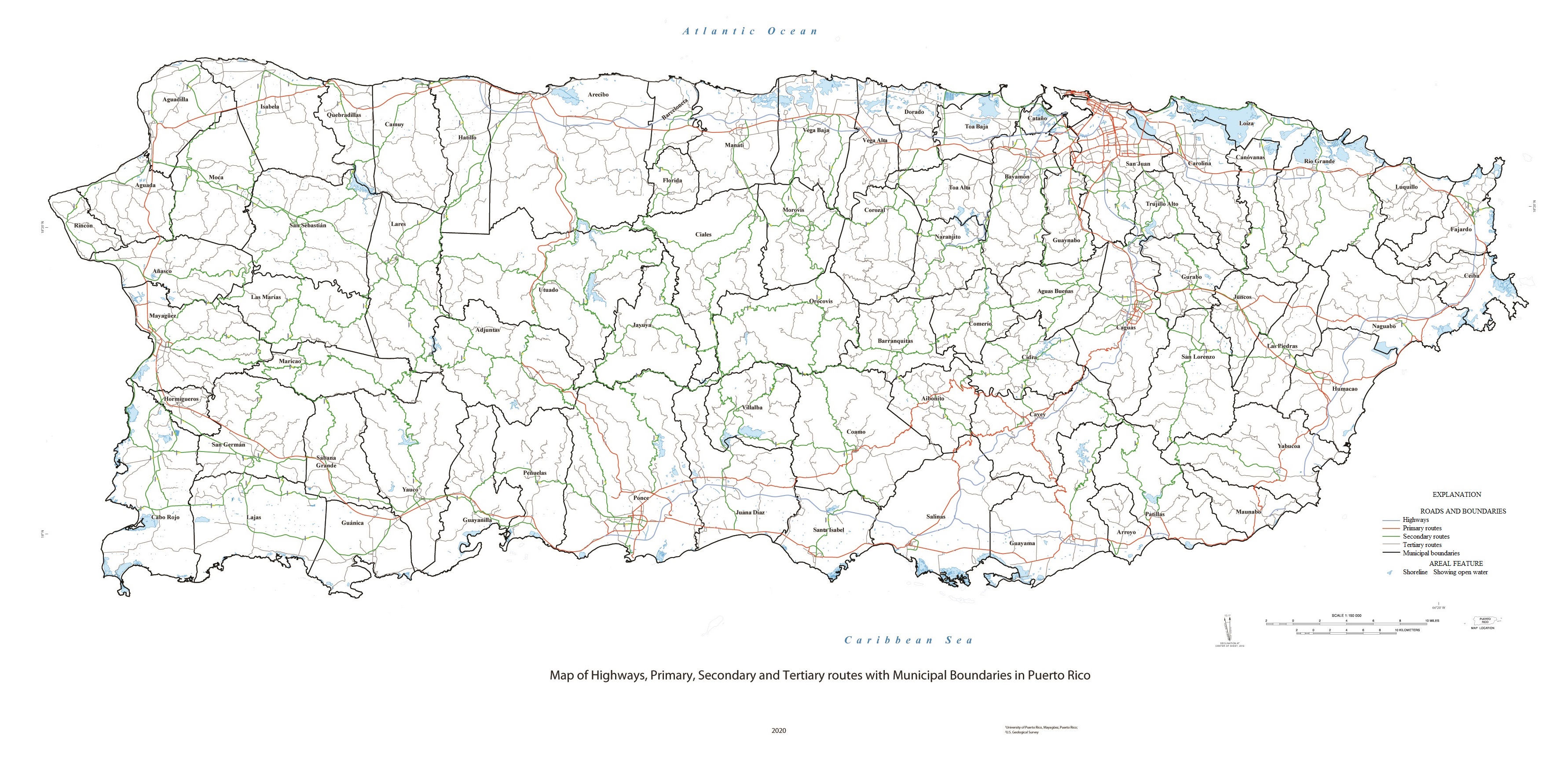
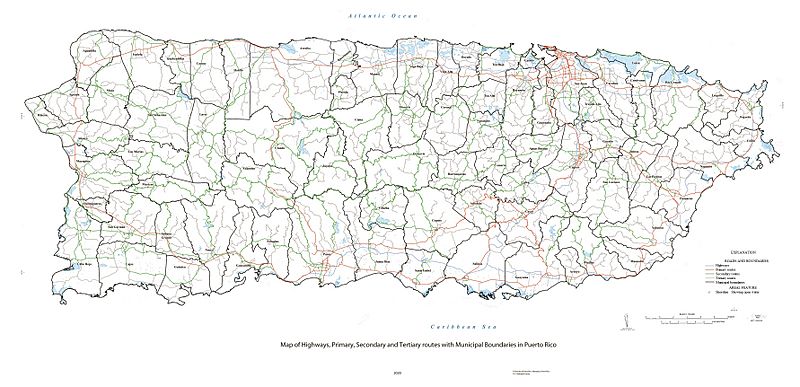
Image: Map of Highways, Primary, Secondary, Tertiary Routes in Puerto Rico
Size of this preview: 800 × 387 pixels. Other resolutions: 320 × 155 pixels | 3,564 × 1,724 pixels.
Original image (3,564 × 1,724 pixels, file size: 1.5 MB, MIME type: image/jpeg)
Description: Map of Highways, Primary, Secondary, Tertiary Routes in Puerto Rico. Waterbodies from U.S. Geological Survey National Hydrography Dataset. Roadways from Puerto Rico Department of Transportation and Public Works.
Title: Map of Highways, Primary, Secondary, Tertiary Routes in Puerto Rico
Credit: https://pubs.usgs.gov/of/2020/1022/ofr20201022_sheet.pdf
Author: Own work based on: Map by US Department of the Interior, US Geological Survey
Usage Terms: Public domain
License: Public domain
Attribution Required?: No
Image usage
The following page links to this image:

All content from Kiddle encyclopedia articles (including the article images and facts) can be freely used under Attribution-ShareAlike license, unless stated otherwise.