
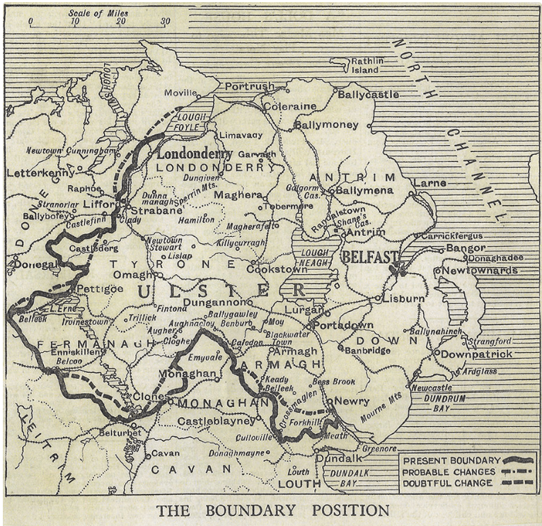
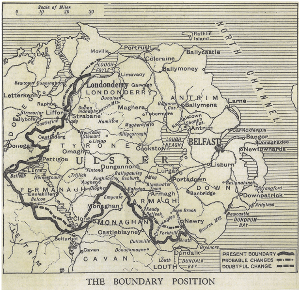
Image: Map of Irish Boundary Commission changes from the Morning Post
Size of this preview: 617 × 599 pixels. Other resolutions: 247 × 240 pixels | 766 × 744 pixels.
Original image (766 × 744 pixels, file size: 541 KB, MIME type: image/png)
Description: Map of Irish Boundary Commission changes from the Morning Post
Title: Map of Irish Boundary Commission changes from the Morning Post
Credit: Original publication: 1925 Immediate source: http://centenariestimeline.com/1925_BCR.html
Author: Morning Post (Life time: 1925)
Usage Terms: Public domain in the United States
License: PD-US
License Link: //en.wikipedia.org/wiki/File:Map_of_Irish_Boundary_Commission_changes_from_the_Morning_Post.png
Image usage
The following page links to this image:

All content from Kiddle encyclopedia articles (including the article images and facts) can be freely used under Attribution-ShareAlike license, unless stated otherwise.