
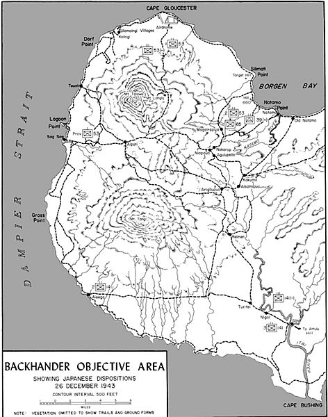
Image: Map of Japanese dispositions around Cape Gloucester

Size of this preview: 472 × 600 pixels. Other resolutions: 189 × 240 pixels | 1,159 × 1,473 pixels.
Original image (1,159 × 1,473 pixels, file size: 401 KB, MIME type: image/jpeg)
Description: Map of Japanese dispositions around Cape Gloucester, late 1943
Title: Map of Japanese dispositions around Cape Gloucester
Credit: Shaw, Henry I. & Douglas T. Kane (1963) Volume II: Isolation of Rabaul, Washington, D.C.: U.S. Marine Corps Government Printing Office, p. 320 OCLC: 432730347.
Author: R.F Stibil
Permission: This file is a work of a United States Marine or employee, taken or made as part of that person's official duties. As a work of the U.S. federal government, it is in the public domain.
Usage Terms: Public domain
License: Public domain
Attribution Required?: No
Image usage
The following page links to this image:

All content from Kiddle encyclopedia articles (including the article images and facts) can be freely used under Attribution-ShareAlike license, unless stated otherwise.