
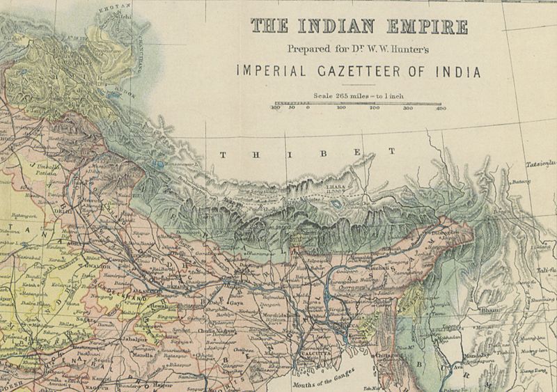
Image: Map of Lhasa, Tibet (Thibet) and the Himalayas in 1885 from 12 of 'The Imperial Gazetteer of India ... Second edition (revised and enlarged)' (11180098823) (cropped)

Description: View this map on the BL Georeferencer service. Image taken from: Title: "The Imperial Gazetteer of India ... Second edition [revised and enlarged]" Author: HUNTER, William Wilson - Sir, K.C.S.I Shelfmark: "British Library HMNTS 010058.f.14.", "British Library OC 15090.g.2." Volume: 07 Page: 12 Place of Publishing: London Date of Publishing: 1885 Publisher: Trübner & Co. Issuance: monographic Identifier: 001772455 Explore: Find this item in the British Library catalogue, 'Explore'. Open the page in the British Library's itemViewer (page image 12) Download the PDF for this book Image found on book scan 12 (NB not a pagenumber)Download the OCR-derived text for this volume: (plain text) or (json) Click here to see all the illustrations in this book and click here to browse other illustrations published in books in the same year. Order a higher quality version from here.
Title: Map of Lhasa, Tibet (Thibet) and the Himalayas in 1885 from 12 of 'The Imperial Gazetteer of India ... Second edition (revised and enlarged)' (11180098823) (cropped)
Credit: Image taken from page 12 of 'The Imperial Gazetteer of India ... Second edition [revised and enlarged]'
Author: The British Library
Permission: The British Library @ Flickr Commons
Usage Terms: No known copyright restrictions
License: No restrictions
License Link: https://www.flickr.com/commons/usage/
Attribution Required?: No
Image usage
The following page links to this image:

_and_the_Himalayas_in_1885_from_12_of_'The_Imperial_Gazetteer_of_India_..._Second_edition_(revised_and_enlarged)'_(11180098823)_(cropped).jpg)