
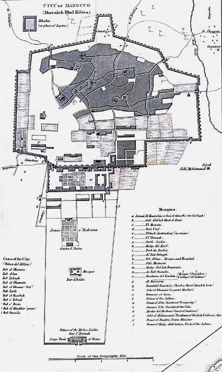
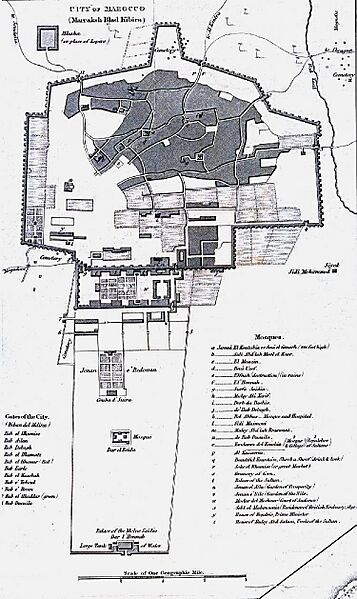
Image: Map of Marrakesh (1830)
Size of this preview: 357 × 599 pixels. Other resolutions: 143 × 240 pixels | 749 × 1,257 pixels.
Original image (749 × 1,257 pixels, file size: 275 KB, MIME type: image/jpeg)
Description: Map of Marrakesh, from 1830. Derivative rom "Marocco from Observations In 1830" with inset map of "City of Marocco (Marraksh Blad Kibira)" from the Journal of the Royal Geographical Society, Volume 1, 1832 to accompany "Geographical Notice of the Empire of Marocco. By Lieutenant Washington, R.N."
Title: Map of Marrakesh (1830)
Credit: Derivative of File:Marocco from observations in 1830.jpg. Originally [1]
Author: Lieutenant Washingon, R.N. (National Geographic Society)
Usage Terms: Public domain
License: Public domain
Attribution Required?: No
Image usage
The following page links to this image:

All content from Kiddle encyclopedia articles (including the article images and facts) can be freely used under Attribution-ShareAlike license, unless stated otherwise.
.jpg)