
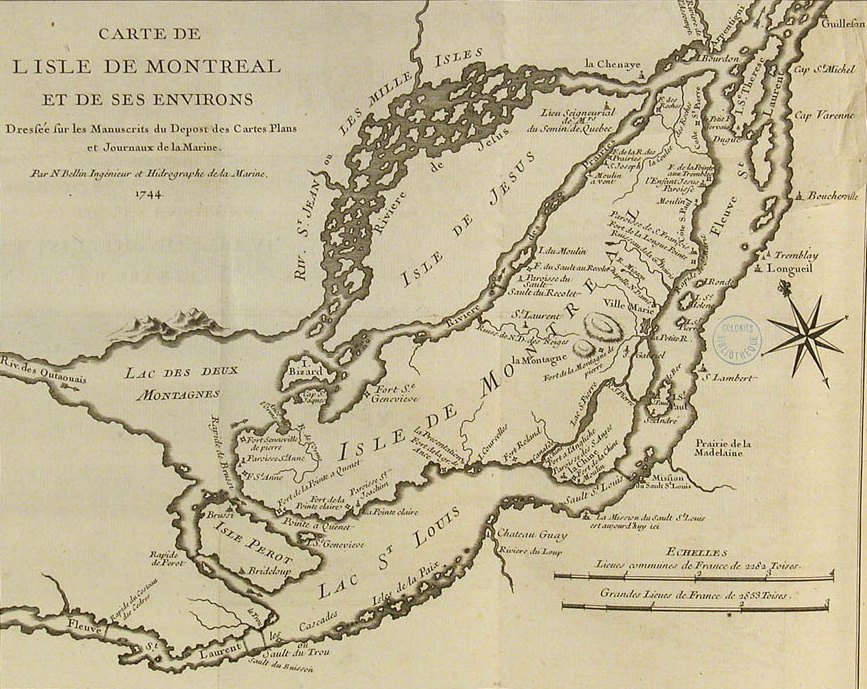
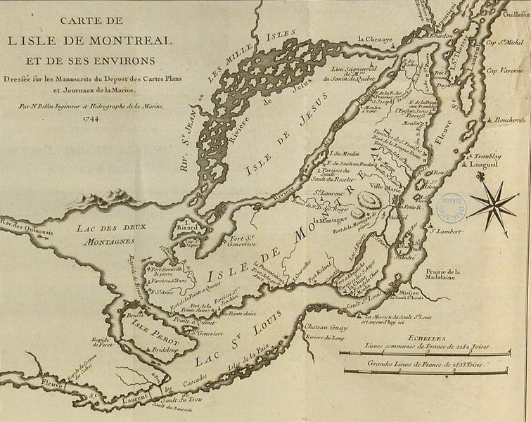
Image: Map of Montreal 1744
Size of this preview: 755 × 600 pixels. Other resolutions: 302 × 240 pixels | 867 × 689 pixels.
Original image (867 × 689 pixels, file size: 184 KB, MIME type: image/jpeg)
Description: Map of the island of Montréal and surrounding area
Title: Map of Montreal 1744
Credit: National Archives of Canada This image is available from Library and Archives Canada This tag does not indicate the copyright status of the attached work. A normal copyright tag is still required. See Commons:Licensing for more information. Library and Archives Canada does not allow free use of its copyrighted works. See Category:Images from Library and Archives Canada.
Author: Jacques-Nicolas Bellin
Permission: See National Archives of Canada Copyright policy
Usage Terms: Public domain
License: Public domain
Attribution Required?: No
Image usage
The following page links to this image:

All content from Kiddle encyclopedia articles (including the article images and facts) can be freely used under Attribution-ShareAlike license, unless stated otherwise.