
Image: Map of Mpumalanga with districts labelled (2011)

Size of this PNG preview of this SVG file: 617 × 599 pixels. Other resolution: 247 × 240 pixels.
Original image (SVG file, nominally 768 × 746 pixels, file size: 267 KB)
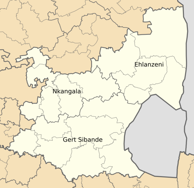
Description: Map of municipal boundaries in Mpumalanga, as they will be after the municipal elections of 18 May 2011, with district and metropolitan municipalities named.
Author: Htonl
Usage Terms: Creative Commons Attribution-Share Alike 3.0
License: CC-BY-SA-3.0
License Link: http://creativecommons.org/licenses/by-sa/3.0/
Attribution Required?: Yes
Image usage
The following page links to this image:

All content from Kiddle encyclopedia articles (including the article images and facts) can be freely used under Attribution-ShareAlike license, unless stated otherwise.
.svg)