
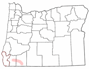
Image: Map of Oregon highlighting Rogue Valley
No higher resolution available.
Map_of_Oregon_highlighting_Rogue_Valley.png (300 × 232 pixels, file size: 24 KB, MIME type: image/png)
Description: Rogue Valley adapted from Wikipedia county maps by Matthew Trump, 2004 The outline of Curry County is still visible (bits of red.) The image should be cleaned up to clarify that the shaded region in Jackson and Josephine Counties is what's intended to be highlighted.
Title: Map of Oregon highlighting Rogue Valley
Credit: Transferred from en.wikipedia
Author: Original uploader was Decumanus at en.wikipedia
Permission: CC-BY-SA-3.0-MIGRATED; GFDL-WITH-DISCLAIMERS; Released under the GNU Free Documentation License.
Usage Terms: Creative Commons Attribution-Share Alike 3.0
License: CC-BY-SA-3.0
License Link: http://creativecommons.org/licenses/by-sa/3.0/
Attribution Required?: Yes
Image usage
The following 3 pages link to this image:

All content from Kiddle encyclopedia articles (including the article images and facts) can be freely used under Attribution-ShareAlike license, unless stated otherwise.