
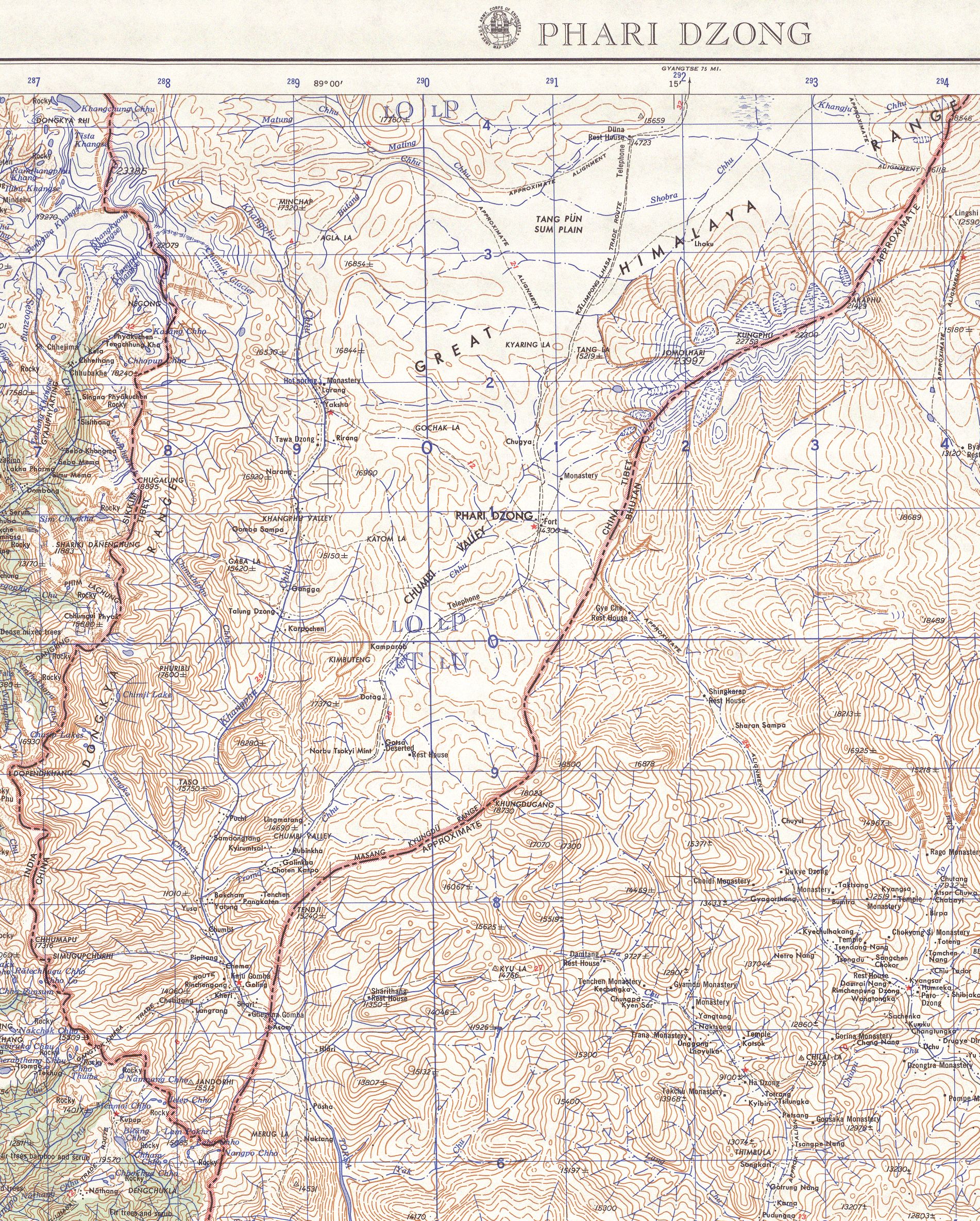
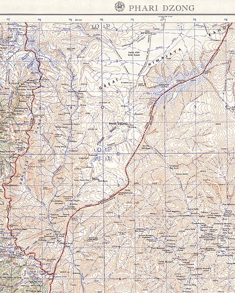
Image: Map of Tibet, Phari Dzong and Chumbi Valley, Tibet in 1963, from- India and Pakistan 1 250,000 Phari Dzong (cropped)
Size of this preview: 481 × 599 pixels. Other resolutions: 193 × 240 pixels | 1,902 × 2,370 pixels.
Original image (1,902 × 2,370 pixels, file size: 1.72 MB, MIME type: image/jpeg)
Description: NG 45-4 Phari Dzong. Tile of the Map India and Pakistan 1:250,000. Series U502, U.S. Army Map Service, 1955
Title: Map of Tibet, Phari Dzong and Chumbi Valley, Tibet in 1963, from- India and Pakistan 1 250,000 Phari Dzong (cropped)
Credit: http://www.lib.utexas.edu/maps/ams/india/txu-oclc-6614190-ng45-4.jpg
Author: U.S. Army Map Service
Usage Terms: Public domain
License: Public domain
Attribution Required?: No
Image usage
The following page links to this image:

All content from Kiddle encyclopedia articles (including the article images and facts) can be freely used under Attribution-ShareAlike license, unless stated otherwise.
.jpg)