Chumbi Valley facts for kids
Quick facts for kids Chumbi Valley |
|
|---|---|
| Dromo, Tromo, Jumo | |
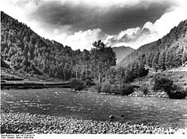
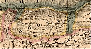
Chumbi Valley, 1938.
|
|
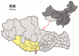 |
|
| Floor elevation | 3,000 m (9,800 ft) |
| Long-axis direction | north-south |
| Naming | |
| Native name | Error {{native name}}: an IETF language tag as parameter {{{1}}} is required (help) |
| Geography | |
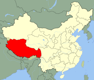
| Location | Tibet, China |
| Population centers | Phari, Yatung |
| Rivers | Amo Chhu |
| Chumbi Valley | |||||||
|---|---|---|---|---|---|---|---|
| Chinese | 春丕河谷 | ||||||
|
|||||||
The Chumbi Valley is a special valley in the Himalayas. People in Tibet call it Dromo or Tromo. It stretches south from the high Tibetan plateau. This valley sits right between Sikkim (which is part of India) and Bhutan. It is also known as Yadong County in the Tibet Autonomous Region of China.
The valley is about 3,000 meters (9,800 feet) above sea level. Because it's on the south side of the Himalayas, it gets more rain. This gives it a milder climate than most of Tibet. You can find lush Eastern Himalayan broadleaf forests here. Further north, it changes to Eastern Himalayan alpine shrub and meadows. A plant called Pedicularis chumbica is even named after this valley.
In 1904, a British India group called the Younghusband Expedition traveled through the Chumbi Valley. They were on their way to Lhasa. After the expedition, the British took control of the valley. This was to make up for war costs. China later agreed to pay Tibet's debt. So, the Chumbi Valley was given back to Tibet on February 8, 1908.
What's in a Name?
The Tibetan name for this area is Gromo. It is pronounced Dromo or Tromo. In the Dzongkha language of Bhutan, it is called Gyumo, pronounced J'umo. The word "Chumbi" comes from J'umbi, which means "from J'umo".
The name "Chumbi" became popular after Joseph Dalton Hooker wrote about the region. He was the first European to describe it. Some people think "Chumbi Valley" only refers to the southern part. They call it Lho Dromo, meaning "southern Dromo". But in English, "Chumbi Valley" usually means the whole valley.
"Chumbi" is also the name of a main town in the southern valley. Some writers say the valley is named after this town. However, Hooker's writings do not confirm this idea.
Where is it?
The Chumbi Valley is shaped like a triangle. It is wider at the northern end. To the west, it has the Chola Range. On the east, it has the Masang Kyungdu Range. This range includes the Khundugang peak.
The Chumbi Valley is part of Tibet, which is now in China. It is located between two Himalayan countries. These are Sikkim to the west and Bhutan to the east. Sikkim is now a state of India.
Why is it Important?
Experts say the Chumbi Valley is very important. It is one of the most strategic places in the Himalayas. It sits like a "dagger" pointing towards India's Siliguri Corridor. This corridor is a narrow strip of land. It is only about 24 kilometers (15 miles) wide. It connects the main part of India to its northeastern states. People often call it the "chicken's neck" because it is so narrow. This makes it a sensitive spot for India. It is also vital for Bhutan's supply routes.
In the past, the Chumbi Valley and Siliguri were part of a trade route. This route connected India and Tibet. In the 1800s, the British wanted to use this route for trade. They gained control over Sikkim. Sikkim has important mountain passes like Nathu La and Jelep La. These passes lead into the Chumbi Valley.
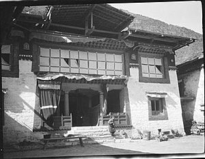
After some treaties, the British set up trading posts. These were in Yatung and Lhasa. They also had soldiers to protect them. This trade continued until 1959. Then, the Chinese government stopped it.
Indian officials say China has been building up its military in the Chumbi Valley. They have built many bases there. In 1967, there were border fights at Nathu La and Cho La passes. The Chinese argued about where the border was. Indian forces had the higher ground. They destroyed many Chinese defenses. Because India and Bhutan control the surrounding heights, China's military position in the valley is thought to be weaker.
China wants to control the Doklam plateau. This area is at the southern edge of the Chumbi Valley. Experts say controlling Doklam would help China in three ways. First, it would give them a great view of the Chumbi Valley. Second, it would help them get around India's defenses in Sikkim. Third, it would overlook the important Siliguri Corridor. If China controlled Doklam, they could watch Indian troops. They could also attack the Siliguri Corridor if there was a war. India sees this as a serious threat.
A Look Back in Time
The Chumbi Valley has been a trade route for a very long time. People used it to trade between Tibet and India over a thousand years ago.
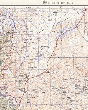
Around the 14th century, a governor named Phakpa Balzang took control of the area. He built a fort and trading centers in Phari. This trade center was important for centuries.
According to stories from Sikkim, the Kingdom of Sikkim included the Chumbi Valley when it was founded in 1642. It also included the Haa Valley and areas like Darjeeling. Over time, Sikkim faced many attacks from Bhutan. These areas often changed hands. The Doklam plateau was likely part of these lands.
After Nepal became united in 1756, Nepal and Bhutan attacked Sikkim together. Later, China got involved in Himalayan politics. After a war with Nepal in 1792, China ordered a land survey. During this survey, the Chumbi Valley was officially declared part of Tibet. Sikkim was not happy about losing land.
In the years that followed, Sikkim worked with the British. They got some land back after a war with Nepal. But Sikkim still felt loyal to Tibet. The British wanted to control Sikkim. So, in 1890, they made a treaty with China. This treaty said Sikkim was a British protectorate. It also set the border between Sikkim and Tibet. This border is still used today. In 1904, the British signed another treaty with Tibet. This confirmed the earlier agreement.
See also
- Nathu La and Cho La clashes
 | Mary Eliza Mahoney |
 | Susie King Taylor |
 | Ida Gray |
 | Eliza Ann Grier |


