
Image: Map of Virginia and Maryland, constructed from the latest authorities (NYPL b15025186-433986) (Cropped for Richmond Petersburg Railroad)
No higher resolution available.
Map_of_Virginia_and_Maryland,_constructed_from_the_latest_authorities_(NYPL_b15025186-433986)_(Cropped_for_Richmond_Petersburg_Railroad).jpg (254 × 255 pixels, file size: 21 KB, MIME type: image/jpeg)
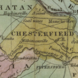
Description: * Includes statistical tables of population according to the census of 1820. Population data for towns and counties pasted on verso of front cover. Inset: Plan of Washington City & Georgetown. National Endowment for the Humanities Grant for Access to Early Maps of the Middle Atlantic Seaboard. Prime meridians Washington and Greenwich. Relief shown by hachures.
Title: Map of Virginia and Maryland, constructed from the latest authorities (NYPL b15025186-433986) (Cropped for Richmond Petersburg Railroad)
Credit: https://digitalcollections.nypl.org/items/510d47da-ee2e-a3d9-e040-e00a18064a99
Author: Scan by NYPL
Usage Terms: Public domain
License: Public domain
Attribution Required?: No
Image usage
The following 2 pages link to this image:

All content from Kiddle encyclopedia articles (including the article images and facts) can be freely used under Attribution-ShareAlike license, unless stated otherwise.
_(Cropped_for_Richmond_Petersburg_Railroad).jpg)