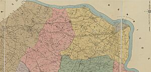
Southside (Richmond, Virginia) facts for kids
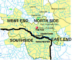
The Southside of Richmond is an area in the larger city region around Richmond, Virginia. It usually includes all parts of the City of Richmond that are south of the James River. This also includes the old city of Manchester. Sometimes, "Southside of Richmond" can also mean parts of nearby Chesterfield County, Virginia. The Chippenham Parkway often acts as a border between the city and county parts of Southside. Some news groups call the city parts "South Richmond."
Contents
- What is Southside Richmond?
- North Chesterfield Area
- History of Southside Richmond
- Late 1800s: Growth Along the Rail Lines
- Unincorporated Towns and Neighborhoods
- Industrial and Commercial Sites
- Commercial Districts
- Parks and Recreation
- Transportation
What is Southside Richmond?
Since there isn't one official group for this area, its borders are not exactly clear. It's generally south of the James River and west of Interstate 95. Its southern border goes to about Chester, Virginia and west along the Virginia State Route 288 highway. Some parts of Southside closest to downtown Richmond (north of the river) are also seen as part of Downtown Richmond.
North Chesterfield Area
<mapframe text="Southside generally covers the area between the James River and SR 288. The Chippenham Parkway (State Route 150) mostly separates the City of Richmond from Chesterfield County." width=445 height=450 zoom=11 latitude=37.46 longitude=-77.55> </mapframe> Some ZIP codes in Southside use "Richmond, Virginia" as their official name. But some of these areas are actually in Chesterfield County, which is a separate local government. For example, the 23235 ZIP code (Bon Air) is partly in the city and partly in the county.
In 2011, the U.S. Postal Service let Chesterfield County use "North Chesterfield, VA" for ZIP codes 23224, 23225, 23234, 23235, 23236, and 23237 when they are in Chesterfield County. This was because some county residents were confused and accidentally paid taxes to the City of Richmond.
People in the 23235 ZIP code in Chesterfield can still use "Bon Air" as their preferred name. They can also use "North Chesterfield, Virginia 23235" or "Richmond, Virginia 23235."
History of Southside Richmond
Early Settlements by the River
The James River is a key feature of Southside Richmond. It was once hard to cross to other parts of the Richmond area. The oldest bridge across the James River in Richmond was Mayo Bridge (built in 1788). Before that, people moved goods using boats and ferries. There were also special port areas with tobacco warehouses, like at Shockoe's (north of the river) and Warwick (south of the river).
1600s: English Settlers and Native Tribes
When the English arrived, two main Native American groups lived in Central Virginia. The Manakins lived west of Richmond towards the Blue Ridge Mountains. The Powhatan Confederacy, led by Wahunsonacock, lived in the Richmond area towards the Virginia Tidewater region.
The first European settlement in this area was in 1611 at Henricus. This was where Falling Creek meets the James River. In 1619, early settlers started the Falling Creek Ironworks to make money. From 1622 to 1646, there were many Anglo-Powhatan Wars. These wars ended the Powhatan Confederacy. After Bacon's Rebellion in 1676, Native American leader Cockacoeske signed a treaty. Several tribes in Central Virginia agreed to be under British rule. They gave up their land claims for protection and some reserved land. By 1699, the Manakins/Monacans had left their settlements. The English then freely settled all over the Richmond area. The English also gave a large area of land to French people seeking safety, called Huguenots, to settle in the old Manakin village on the south side of the James River.
1700s: Warwick and River Trade
After building important structures in Williamsburg, Henry Cary built the Ampthill plantation in 1730 near Warwick. From 1750 to 1781, his son Archibald ran the Falling Creek Ironworks at Warwick. Because of port traffic, Warwick Road became a very important road through Southside for the next two centuries. It especially helped people get around the waterfalls on the James River.
West of the James River waterfalls, the descendants of the 1700 Huguenot settlers in Manakintown started mixing with the English. They settled across Powhatan and western Chesterfield County. They started family coal mining businesses like Black Heath. One of these Huguenot descendants, Abraham Salle, built Salisbury Plantation. In 1777, he sold it to the Randolph Family. They lived across the river at Tuckahoe and used Salisbury for hunting. Patrick Henry rented Salisbury and lived there with his family when he was governor in 1786.
Early 1800s: Manchester Grows and Rail Lines to Coal Mines
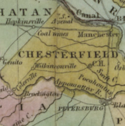
After the port of Warwick was destroyed in the Revolutionary War, Warwick Road was still used. But the port of Manchester became the main port. Also, the James River and Kanawha Canal opened in 1790. This canal helped boats travel up the James River from Richmond to Westham.
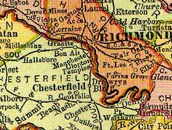
In 1804, Virginia built the first version of the Midlothian Turnpike. This road went from the port of Manchester west to Falling Creek. It helped access the coal mines at Midlothian. This allowed places like the Black Heath coal mines and Bellona Arsenal to ship goods down the James River without going through Warwick.
Railroads helped quickly move coal from the mines in western Chesterfield County. The Clover Hill Railroad Company started in 1841. The Clover Hill Railroad opened in 1845, connecting Chester to the Clover Hill Pits near Winterpock.
Late 1800s: Growth Along the Rail Lines
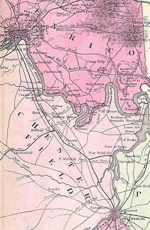
During the Civil War, the Confederacy mostly kept Union troops west of the Richmond and Petersburg Railroad. The Bermuda Hundred Campaign was a main exception. Until the war ended, Drewry's Bluff stopped the Union army from reaching Richmond by water.
The Clover Hill Railroad went out of business in 1877. But it was restarted in 1881 as the Brighthope Railway. It ran until World War I, when it was taken apart and sent to France to help with the war effort.
The city of Manchester became important because of its 1831 Chesterfield Railroad and its 1853 replacement, the Richmond and Danville Railroad.
Suburban train stations along the Richmond and Danville Railroad led to growth in places like Granite, Virginia (a mining area, post office opened 1872), Bon Air (a resort started in 1877), Robious, and Midlothian. These stops became centers for industry and homes in what were otherwise rural areas. They often moved people and goods through Manchester and Richmond.
Manchester also benefited from being a stop on the North-South Richmond and Petersburg Railroad. Manchester was briefly the county seat of Chesterfield County after the Civil War, from 1870 to 1876. In 1874, Manchester voted to become an independent city. In 1876, the Chesterfield County seat moved to Chesterfield Courthouse.
1900s: Growth and Annexation in the Car Era
<mapframe text="The slow decline of the Jeff Davis corridor began with the 1958 construction of the I-95 Richmond-Petersburg Turnpike, running about 1 mile to its east." width=200 height=800 zoom=12 latitude=37.44 longitude=-77.43/>
1910 Annexation of Manchester
From its start in the 1750s until the late 1800s, Chesterfield County was the local government for most of what is now Southside. Manchester became an independent city in 1876. Then, in 1910, Manchester agreed to become part of the City of Richmond. During the talks, Manchester asked for a free bridge to be built so its residents could easily get to Richmond. This became the Manchester Bridge. As cars became popular, other bridges were built, including Westham Bridge (1911), the Nickel Bridge (1925—a toll bridge), and the Lee Bridge (1933—also a toll bridge).
Car-based Growth and 1942 Annexation
In 1922, Chesterfield took over the Henricus site from Henrico County.
In 1927, after ten years of road improvements, the Jefferson Davis Highway officially opened as a major road for cars.
These car roads attracted new buildings and businesses. The DuPont Spruance plant opened in 1929 along the Jefferson Davis Highway. It made rayon, Cordura, and cellophane on the old site of the Ampthill Plantation.
Traffic along Jefferson Davis Highway and its James River toll bridge led to Belt Boulevard by 1933. This road bypassed downtown Richmond and sent some traffic to the Nickel Bridge. Easier car access helped Southside grow. By 1940, a guide to Virginia said that south of Richmond, U.S. 1 was "lined with tourist cabins, garages, and lunchrooms."
During annexations in 1914 and 1942, Richmond took more and more land from Chesterfield County. This included Westover Hills and Forest Hill to the west, and The Port of Richmond (built 1940) to the south.
Postwar Growth: Bellwood, Southside Plaza, I-95 and Chippenham Parkway
After World War II, Southside grew a lot. A large military supply center was built in 1942 on the Bellwood property. The Bellwood Drive-In opened outside the city in 1948. It was called the "largest and finest" drive-in theater in the South.
The Southside Plaza shopping center opened in 1957-58 outside the city limits on Belt Boulevard in what was then Chesterfield County.
In 1958, the Richmond–Petersburg Turnpike toll road opened between Richmond and Petersburg. The Chippenham Parkway was built in 1967. It connected much of Southside from the Midlothian Turnpike to the Defense Supply Center, Richmond.
Before I-95 was built, Route 1/Jefferson Davis Highway was the main road. I-95 and Chippenham Parkway took traffic away from both the Jeff Davis Corridor and Belt Boulevard.
1970 Annexation to Chippenham Parkway
In 1970, Richmond took another 23 square miles from Chesterfield County, reaching all the way to the Chippenham Parkway. The reasons for this expansion led to a Supreme Court case and a stop to further annexations. During the talks, much of Bon Air to the west and the Ampthill property to the south stayed in Chesterfield County.
Powhite Parkway and Extension
<mapframe text="As suburban development moved southwest along US-60, VA-76, and VA-150, the Southside Plaza (A) became less important than Cloverleaf Mall (B) in 1972 and Chesterfield Mall (C) in 1978. In 1988, the Powhite Parkway Extension opened, allowing fast travel from the Chippenham Parkway to the new Virginia State Route 288. The Stony Point Fashion Park (D) was built in 2003." width=550 height=300 zoom=12 latitude=37.52 longitude=-77.53> { "type": "FeatureCollection", "features": [ { "type": "Feature", "properties": {"title": "Southside Plaza (1958)", "marker-symbol": "-letter-see"}, "geometry": {"type": "Point", "coordinates": [-77.47655153274536, 37.50216800393298]} }, { "type": "Feature", "properties": {"title": "Cloverleaf Mall (1972)", "marker-symbol": "-letter-see"}, "geometry": {"type": "Point", "coordinates": [-77.52811431884766, 37.49896760729101]} }, { "type": "Feature", "properties": {"title": "Chesterfield Mall (1978)", "marker-symbol": "-letter-see"}, "geometry": {"type": "Point", "coordinates": [-77.60866641998291, 37.507853476646744]} }, { "type": "Feature", "properties": {"title": "Stony Point Fashion Park (2003)", "marker-symbol": "-letter-see"}, "geometry": {"type": "Point", "coordinates": [-77.56935596466064, 37.5499873691089]} }, { "type": "Feature", "properties": {"title": "Brandermill(1977)", "marker-symbol": "-letter-see"}, "geometry": {"type": "Point", "coordinates": [-77.65548706054686, 37.45714557062557]} }, { "type": "Feature", "properties": {"title": "SR-288 bridge (2004)", "marker-symbol": "-letter-see"}, "geometry": {"type": "Point", "coordinates": [-77.6846694946289, 37.57750788488201]} }, { "type": "Feature", "properties": {"title": "Powhite Parkway extension (1988)" }, "geometry": { "type": "LineString", "coordinates": [ [-77.52777099609375, 37.52606450059144], [-77.56210327148436, 37.49447320172351], [-77.59265899658202, 37.46477609130588], [-77.63729095458984, 37.46096092829945] ]} } ]} </mapframe>
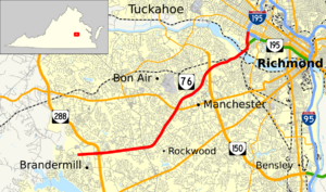
The Powhite Parkway opened in 1973. It connected downtown to the Chippenham Parkway. With new highway access, the number of people living in Southside's suburbs grew very fast. New shopping malls were built outside the city limits. These included Cloverleaf Mall (1972) and Chesterfield Mall (1978). The Brandermill neighborhood was also built in 1977 near the Swift Creek Reservoir. Plans were made to extend the Powhite Parkway from Chippenham to Virginia State Route 288. This extension was finished in 1988. In 1973, Philip Morris USA opened a cigarette factory along I-95. The McGuire VA Hospital opened in 1983.
1988-2004: New Bridges Connect West End and Southside
Before 1988, the main way to get from Southside to the West End was over the Huguenot Bridge or by crossing the James River inside Richmond city. This led to a small rivalry. In 1988, Southside connected to Parham Road in the West End through a Chippenham extension and the new Edward E. Willey Bridge. In 1992, the state removed tolls on the I-95 Richmond–Petersburg Turnpike. In 1996, state leaders said the Chippenham Parkway would be extended eastward with a bridge across the James River. This would allow faster access to Interstate 295 (Virginia) and the Richmond International Airport. The bridge and toll highway opened in 2002 as Virginia State Route 895, also known as the "Pocahontas Parkway."
Southside Developments from 2000 to Today
In 2004, Route 288 was extended north from Brandermill through Powhatan and Goochland Counties. It crossed the river at the World War II Veterans Memorial Bridge (Virginia) and completed the highway loop around Richmond. This led to new neighborhoods in Chesterfield County, like The Grove near Midlothian Mines Park and Winterfield. A shopping area called Westchester Commons was also built at Midlothian Turnpike and 288. Developments near the Route 288 bridge include the Tarrington housing area near James River High School and the widening of Robious Road.
Closer to Richmond, the Stony Point Fashion Park opened in 2003. Along the James River, Forest Hill Avenue has seen a rebirth as some people prefer to stay in the city. Events like the South of the James farmer's market bring many people to Forest Hill Park every weekend.
Further west along the I-95 / Route 1 Corridor, city and county leaders are thinking about how to improve the Jefferson Davis Corridor. While it faces economic challenges, it has a strong immigrant population, especially Latino. As Manchester has seen new life with historic tax credits used to fix up old buildings, the historically Black Swansboro and Blackwell neighborhoods are now part of big discussions about gentrification.
Unincorporated Towns and Neighborhoods
- Adams Park
- Beaufont
- Bellemeade
- Belmont Woods
- Belt Center
- Blackwell
- Bon Air
- British Camp Farms
- Broad Rock
- Brookbury
- Brookhaven Farms
- Cedarhurst
- Cherry Gardens
- Chippenham Forest
- Cofer
- Cottrell Farms
- Cullenwood
- Davee Gardens
- Deerbourne
- Elkhardt
- Fawnbrook
- Forest Hill / Gravel Hill
- Forest Hill Park
- Forest Hill Terrace
- Forest View
- Granite
- Hickory Hill
- Hillside Court
- Hioaks
- Huguenot
- Jahnke
- Jeff Davis
- Old Town Manchester
- Maury
- McGuire
- McGuire Manor
- Meadowbrook
- Midlothian
- Murchies Mill
- Northrop
- Oak Grove
- Oxford
- Piney Knolls
- Pocoshock
- Powhite Park
- Reedy Creek
- Reservoir Heights
- South Garden
- Southampton
- Southwood
- Springhill
- Stony Point
- Stratford Hills
- Swansboro
- Swansboro West
- Swanson
- Walmsley
- Warwick
- Westlake Hills
- Westover
- Westover Hills
- Westover Hills West
- Willow Oaks
- Windsor
- Woodhaven
- Woodland Heights
- Worthington
Industrial and Commercial Sites
- Defense Supply Center, Richmond (DSCR)
- Philip Morris USA manufacturing center
- Overnite Transportation (now part of United Parcel Service)
- Deepwater Terminal (Port of Richmond)
- Chippenham Johnston Willis (CJW) Medical Center
Commercial Districts
- Stonebridge Shopping Center (formerly Cloverleaf Mall) and Spring Rock Green (Formerly Beaufont Plaza)
- Old Manchester
- Hull Street Corridor
- Midlothian Turnpike
- Westover Hills
- Stratford Hills
- Stony Point Fashion Park
- The Arboretum
- Bellwood flea market
- Bermuda Square
- Sycamore Square
- Oxbridge Square
- Chesterfield Meadows
Parks and Recreation
- James River Park System
- Forest Hill Park
- Canoe Run Park
- Powhite Park
Transportation
Major Streets and Roads
- Interstate 95 (formerly Richmond-Petersburg Turnpike)
- Jefferson Davis Highway (U.S. Route 1 and U.S. Route 301)
- Forest Hill Avenue (a short part is U.S. Route 60)
- Semmes Avenue (U.S. Route 60)
- Belt Boulevard (State Route 161)
- Iron Bridge Road (State Route 10)
- Broad Rock Road (State Route 10)
- Huguenot Road (State Route 147)
- Courthouse Road (State Route 653)
- Hull Street (U.S. Route 360)
- Midlothian Turnpike (U.S. Route 60)
- Chippenham Parkway (State Route 150)
- Pocahontas Parkway (State Route 895)
- Powhite Parkway (State Route 76)
- State Route 288
Bridges Over James River
- James River Bridge (Interstate 95)
- Mayo Bridge (U.S. Route 360)
- Manchester Bridge (U.S. Route 60)
- Robert E. Lee Memorial Bridge (U.S. Route 1 and U.S. Route 301)
- Boulevard Bridge (State Route 161)
- Powhite Parkway James River Bridge (State Route 76)
- Huguenot Memorial Bridge (State Route 147)
- Edward E. Willey Bridge (State Route 150)
- World War II Veterans Memorial Bridge (State Route 288)
 | William Lucy |
 | Charles Hayes |
 | Cleveland Robinson |


