
James River Park System facts for kids


The James River Park System (often called James River Park or just JRPS) is a huge park in Richmond, Virginia. It covers about 550 acres (223 hectares) along the James River. The park has many different parts, stretching from the Huguenot Memorial Bridge in the west to past the I-95 Bridge in the east. It's managed by the city of Richmond to give everyone a great place to enjoy nature.
Contents
How the Park Started
The James River Park System was officially created by the City of Richmond in 1972. Before that, the land was made up of several private properties that were given to the city.
A Gift of Land
The first big piece of land for the park was given in 1966. A scout leader named Charles Joseph “Joe” Schaefer helped make this happen. He wanted his scouts to camp on a James River island but couldn't get permission. This made him and a friend decide to find a two-mile stretch of river property to donate to the city. Their goal was to create a public park for everyone to use.
Making the Park Better
In 1980, a person named Ralph White was hired to work for the JRPS. At that time, the river wasn't in great shape because of trash and years of industrial use. Ralph White later became the manager of the park. For 32 years, he worked hard to improve the JRPS. He encouraged community groups to volunteer and help clean up the river. Thanks to his efforts, the park became a much better place for people and wildlife. Ralph White retired in 2012.
Protecting the Park Forever
In 2009, a special agreement called a conservation easement was put in place for parts of the James River Park System. This agreement helps protect the park land. It means that future building on these parts of the park is limited. This helps make sure the park stays a natural, open space for many years to come. The city can still do regular maintenance and replace things that are already there.
Explore the Park's Sections
The James River Park System has grown over time and now includes many different sections. Some people say there are currently 19 parts! These sections offer different ways to enjoy the river and its surroundings. Here are some of them, listed from west to east:
- Huguenot Flatwater: This area is perfect for calm water activities like kayaking, canoeing, and paddleboarding. You can explore Nash's Island and Channing's Island, which are great spots to relax. There's also a sandy beach across from the main launch point.
- Pony Pasture Rapids: A popular spot for enjoying the river's rapids.
- The Wetlands: An important natural area with unique plants and animals.
- Main Area: This large section includes places like 43rd Street, the Buttermilk Trail for hiking and biking, the Park Headquarters, and 22nd Street, which has a walking path to Belle Isle.
- Manchester Climbing Wall: A fun place for rock climbing.
- Ancarrow's Landing/Manchester Docks: Access points to the river.
- Pumphouse Park and North Bank Trailhead: Near Byrd Park, offering trails and history.
- Texas Beach/North Bank Trail: Another part of the North Bank Trail, close to Maymont park.
- Access to Belle Isle: You can reach Belle Isle by walking across the Belle Isle Pedestrian Bridge.
- Tredegar Street put-in: A place to launch boats onto the river.
- Pipeline (or Trestle) Trail: This trail offers amazing views, including a place where herons build their nests.
- Great Shiplock Park/Chapel Island: Another interesting area along the river.
Images for kids
-
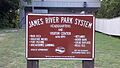
Sign at James River Park System headquarters
-
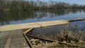
Floating dock on the James River
