
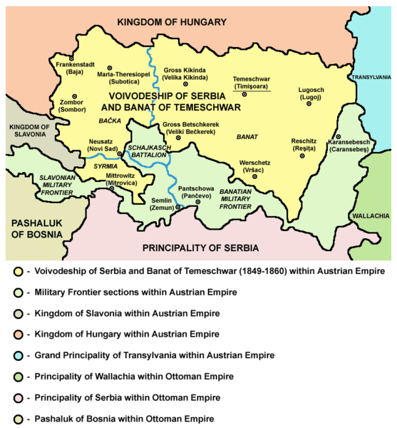
Image: Map of Voivodeship of Serbia and Banat of Temeschwar (1849-1860)

Size of this preview: 557 × 600 pixels. Other resolutions: 223 × 240 pixels | 769 × 828 pixels.
Original image (769 × 828 pixels, file size: 95 KB, MIME type: image/png)
Title: Map of Voivodeship of Serbia and Banat of Temeschwar (1849-1860)
Usage Terms: Public domain
License: Public domain
Attribution Required?: No
Image usage
The following 3 pages link to this image:

All content from Kiddle encyclopedia articles (including the article images and facts) can be freely used under Attribution-ShareAlike license, unless stated otherwise.
.png)