
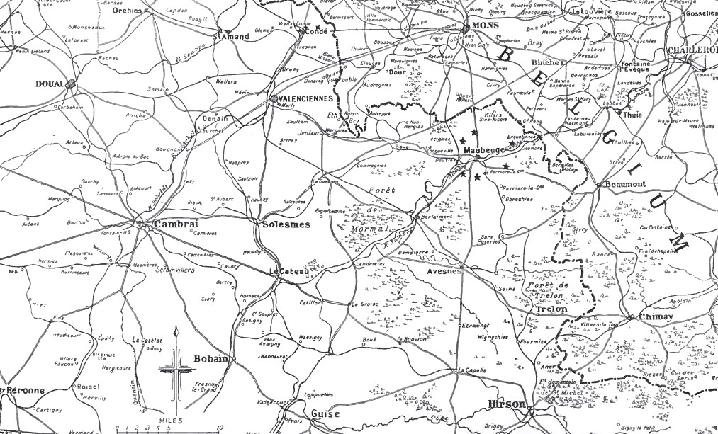
Image: Map of initial area of BEF operations, 1914
Size of this preview: 800 × 484 pixels. Other resolutions: 320 × 194 pixels | 1,013 × 613 pixels.
Original image (1,013 × 613 pixels, file size: 238 KB, MIME type: image/jpeg)
Description: Map of initial area of BEF operations, 1914
Title: Map of initial area of BEF operations, 1914
Credit: Anon (1914–1921) The Times History of the War Vol I, London: The Times Retrieved on 30 November 2013. OCLC: 642276.
Author: AnonymousUnknown author
Usage Terms: Public domain
License: Public domain
Attribution Required?: No
Image usage
The following page links to this image:

All content from Kiddle encyclopedia articles (including the article images and facts) can be freely used under Attribution-ShareAlike license, unless stated otherwise.