
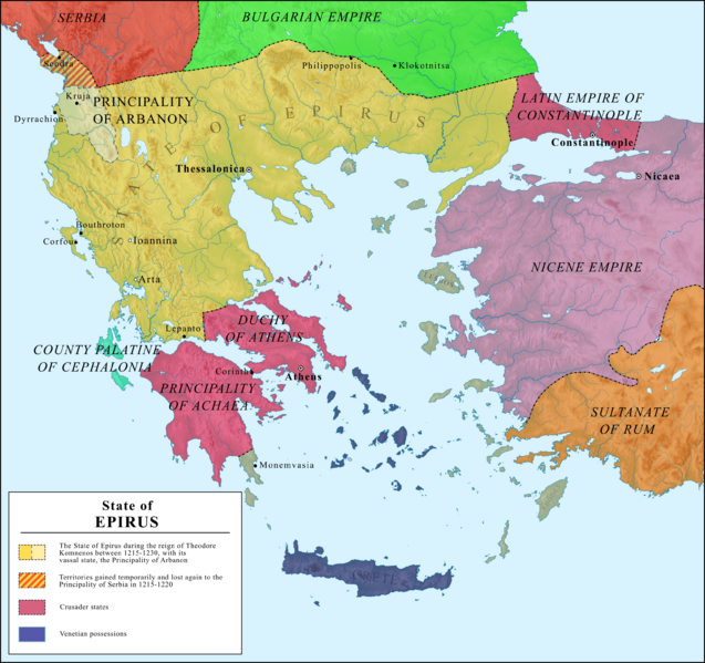
Image: Map of the Empire of Thessalonica

Description: Map of the State of Epirus, 1215-1230
Title: Map of the Empire of Thessalonica
Credit: Own work, based on following sources: Van Antwerp Fine Jr., John (1994) The Late Medieval Balkans: A Critical Survey from the Late Twelfth Century to the Ottoman Conquest, University of Michigan Press, p. 104−105 Osswald, Brendan (2011). "L'Epire du treizième au quinzième siècle : autonomie et hétérogénéité d'une région balkanique (Thèse)". Université Toulouse le Mirail - Toulouse II: 70. Topography taken from the vectorial map of Greece, made by Future Perfect at Sunrise. File:Greece large topographic basemap.svg
Author: Ahmet Q.
Usage Terms: Creative Commons Attribution-Share Alike 4.0
License: CC BY-SA 4.0
License Link: https://creativecommons.org/licenses/by-sa/4.0
Attribution Required?: Yes
Image usage
The following 2 pages link to this image:
