
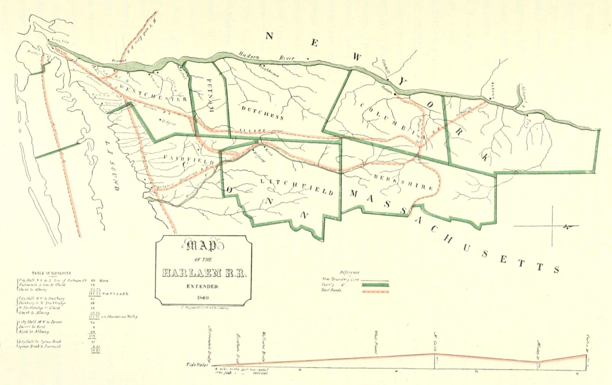
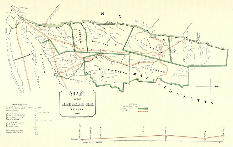
Image: Map of the Harlaem Rail Road extended, 1840
Size of this preview: 800 × 504 pixels. Other resolutions: 320 × 202 pixels | 2,140 × 1,348 pixels.
Original image (2,140 × 1,348 pixels, file size: 303 KB, MIME type: image/jpeg)
Description: Map of the Harlaem Rail Road extended, 1840, showing planned connection with New York and Erie Railroad
Title: Map of the Harlaem Rail Road extended, 1840
Credit: Between the Ocean and the Lakes: The Story of Erie" (1899). p. 57
Author: Edward Harold Mott
Usage Terms: Public domain
License: Public domain
Attribution Required?: No
Image usage
The following page links to this image:

All content from Kiddle encyclopedia articles (including the article images and facts) can be freely used under Attribution-ShareAlike license, unless stated otherwise.