
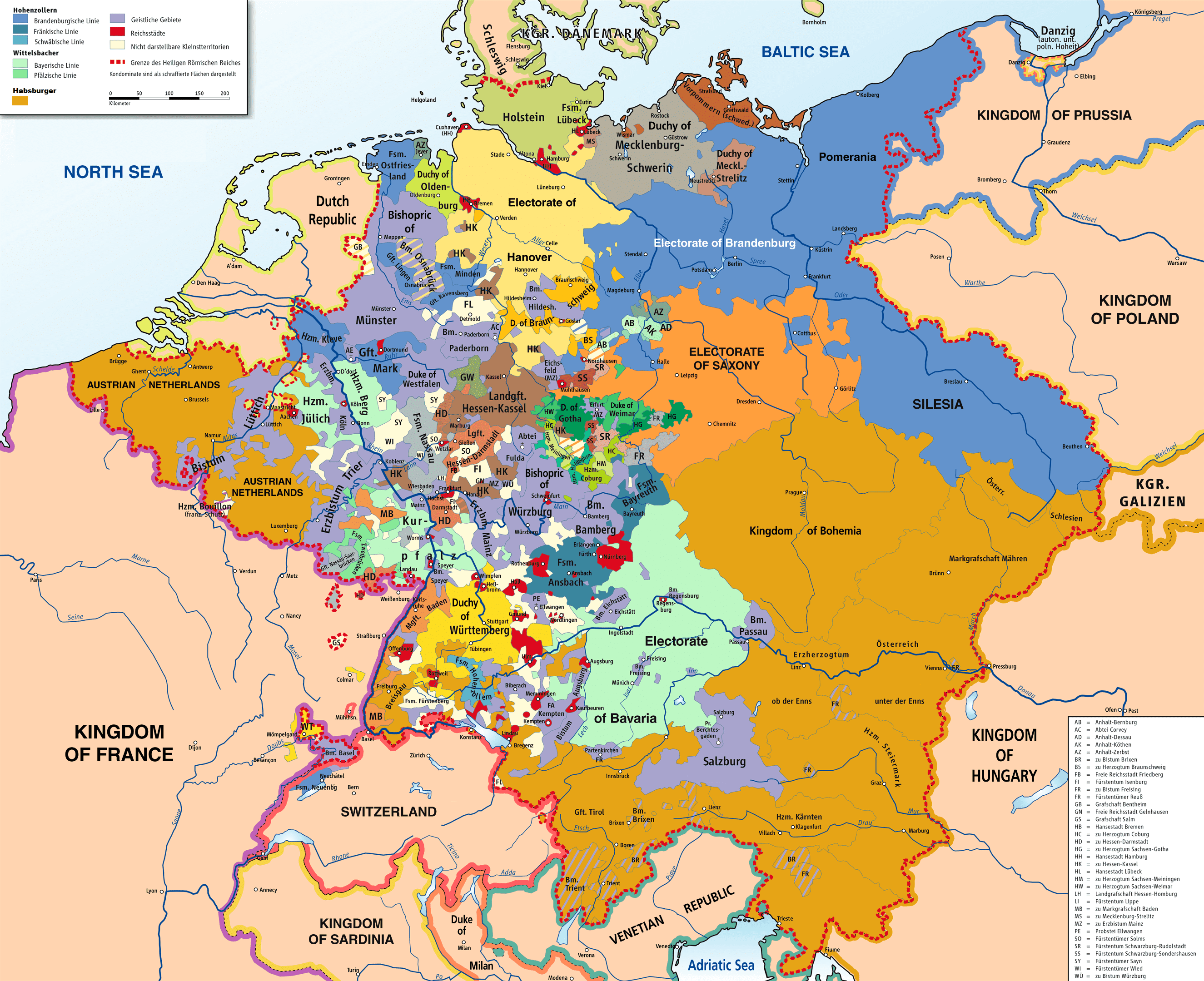
Image: Map of the Holy Roman Empire, 1789 en
Description: Map of the Holy Roman Empire, 1789.
Title: Map of the Holy Roman Empire, 1789 en
Credit: Own work based on: HRR 1789.png "translated (somewhat) from original German version" References: Putzger, F. W. (1965) Historischer Weltatlas (89th ed.) (1969) Westermanns Großer Atlas zur Weltgeschichte, Georg Westermann Verlag Haacks geographischer Atlas. VEB Hermann Haack Geographisch-Kartographische Anstalt, Gotha/Leipzig, 1. Auflage, 1979 Kinder, Hermann (1989) Dtv-Atlas Weltgeschichte / 2, Von der Französischen Revolution bis zur Gegenwart. (23rd ed.), Munich: Dt. Taschenbuch-Verl ISBN: 3-423-03002-X. OCLC: 313766861.
Author: Robert Alfers, ziegelbrenner
Usage Terms: Creative Commons Attribution-Share Alike 3.0
License: CC BY-SA 3.0
License Link: https://creativecommons.org/licenses/by-sa/3.0
Attribution Required?: Yes
Image usage
The following page links to this image:
