
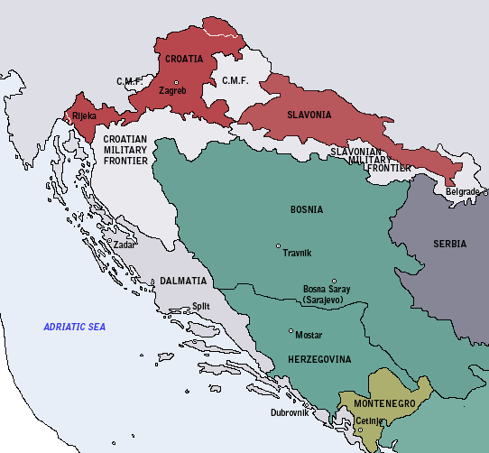
Image: Map of the Kingdom of Croatia (1848)
No higher resolution available.
Map_of_the_Kingdom_of_Croatia_(1848).png (542 × 502 pixels, file size: 16 KB, MIME type: image/png)
Description: Map of the Kingdom of Croatia in early 1848, at its greatest territorial extent. At the time, the Kingdom of Slavonia was a subordinate autonomous kingdom within the Kingdom of Croatia.
Title: Map of the Kingdom of Croatia (1848)
Credit: Own work
Author: DIREKTOR
Usage Terms: Public domain
License: Public domain
Attribution Required?: No
Image usage
The following page links to this image:

All content from Kiddle encyclopedia articles (including the article images and facts) can be freely used under Attribution-ShareAlike license, unless stated otherwise.
.png)