
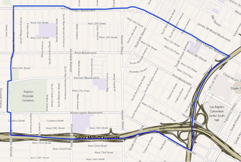
Image: Map of the Pico-Union neighborhood of Los Angeles, California

Size of this preview: 800 × 539 pixels. Other resolutions: 320 × 215 pixels | 900 × 606 pixels.
Original image (900 × 606 pixels, file size: 658 KB, MIME type: image/png)
Description: Map of the Pico-Union neighborhood of Los Angeles, California. Located southwest of Downtown Los Angeles. As delineated by the "Los Angeles Times".
Title: Map of the Pico-Union neighborhood of Los Angeles, California
Credit: http://projects.latimes.com/mapping-la/neighborhoods/neighborhood/pico-union/
Author: Los Angeles Times
Usage Terms: Creative Commons Attribution 2.0
License: CC BY 2.0
License Link: http://creativecommons.org/licenses/by/2.0
Attribution Required?: Yes
Image usage
The following page links to this image:

All content from Kiddle encyclopedia articles (including the article images and facts) can be freely used under Attribution-ShareAlike license, unless stated otherwise.