
Image: Map of the Qualla Indian Reserve Boundary NC

Size of this preview: 408 × 599 pixels. Other resolutions: 163 × 240 pixels | 3,496 × 5,133 pixels.
Original image (3,496 × 5,133 pixels, file size: 2.48 MB, MIME type: image/jpeg)
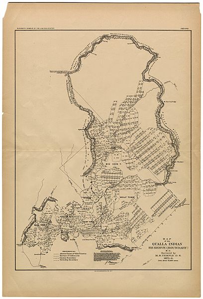
Description: Map of the Qualla Boundary
Title: Map of the Qualla Indian Reserve Boundary NC
Credit: Map of the Qualla Indian Reserve (Boundary) N.C.
Author: United States Census Office based on survey by M. S. Temple
Usage Terms: Public domain
License: Public domain
Attribution Required?: No
Image usage
The following page links to this image:

All content from Kiddle encyclopedia articles (including the article images and facts) can be freely used under Attribution-ShareAlike license, unless stated otherwise.