
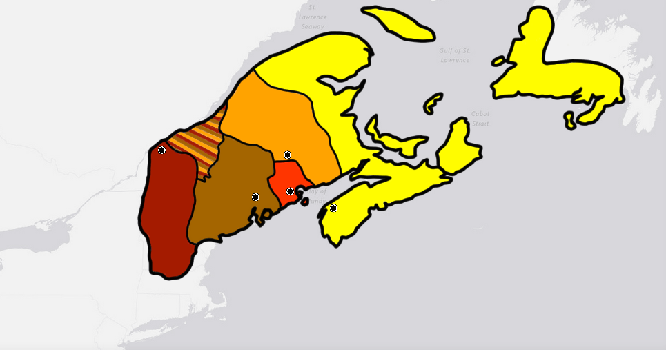
Image: Map of the Wabanaki Confederacy Range
Description: This is the max range of the Wabanaki Confederacy based off of cultural boundaries of the five tribal populations that made it up at around its formation in the early 1,600's. Yellow is the Miꞌkmaq. Orange is the Wəlastəkwewiyik (Maliseet), Red is the Passamaquoddy, Brown is the Penobscot, and Cayenne is the Western Abanaki. The large mixed area to the north was part of Wabanaki territory but is not part of the cultural boundaries of the individual 5 tribes. This may in part be due to it's recent acquisition (In relationship to the formation of Wabanaki) from Iroquois tribes that were pushed out of the area as identified by Samuel de Champlain during the establishment of Quebec City. Algonquin people would have started moving into the land around the same time the French would.
Title: Map of the Wabanaki Confederacy Range
Credit: Own work
Author: Wolastoq
Usage Terms: Creative Commons Zero, Public Domain Dedication
License: CC0
License Link: http://creativecommons.org/publicdomain/zero/1.0/deed.en
Attribution Required?: No
Image usage
The following page links to this image:
