
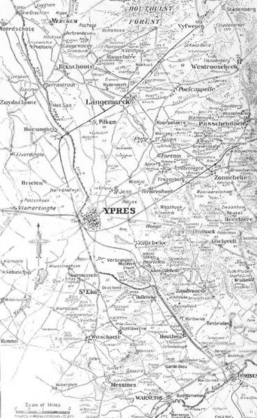
Image: Map of the Ypres district

Size of this preview: 369 × 599 pixels. Other resolutions: 148 × 240 pixels | 857 × 1,391 pixels.
Original image (857 × 1,391 pixels, file size: 798 KB, MIME type: image/png)
Description: Map of the Ypres district
Title: Map of the Ypres district
Credit: The Times history of the war : 1914-1918. Publisher: London : Times, 1921. OCLC Number: 55416751
Author: The Times staff writers
Usage Terms: Public domain
License: Public domain
Attribution Required?: No
Image usage
The following page links to this image:

All content from Kiddle encyclopedia articles (including the article images and facts) can be freely used under Attribution-ShareAlike license, unless stated otherwise.