
Image: Map of the northern parts of the United States of America (1804)
Size of this preview: 800 × 562 pixels. Other resolutions: 320 × 225 pixels | 5,530 × 3,888 pixels.
Original image (5,530 × 3,888 pixels, file size: 5.34 MB, MIME type: image/jpeg)
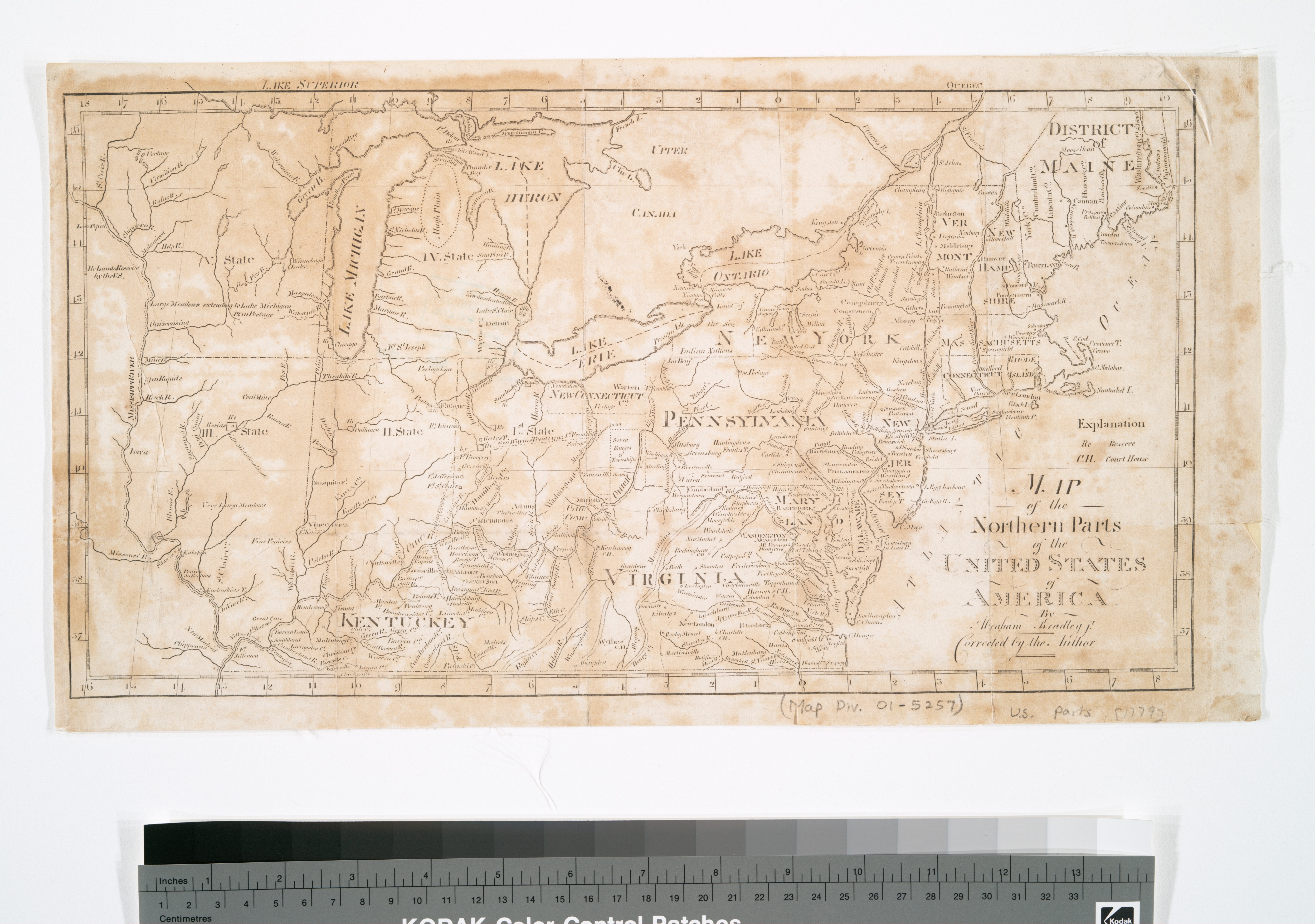
Description: An 1804 map of States north of Virginia and Kentucky, to include the Northwest Territories
Title: Map of the northern parts of the United States of America (1804)
Credit: Lionel Pincus and Princess Firyal Map Division, The New York Public Library. "Map of the northern parts of the United States of America" New York Public Library Digital Collections. Accessed January 13, 2016. https://digitalcollections.nypl.org/items/510d47da-ee72-a3d9-e040-e00a18064a99
Author: Etheridge, Samuel (1771-1817 ) (Printer) Thomas & Andrews (Publisher) Bradley, Abraham (d. 1838) (Cartographer)
Usage Terms: Public domain
License: Public domain
Attribution Required?: No
Image usage
The following page links to this image:

All content from Kiddle encyclopedia articles (including the article images and facts) can be freely used under Attribution-ShareAlike license, unless stated otherwise.
.jpg)