
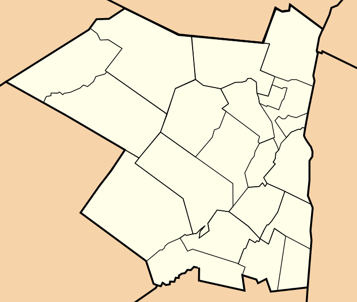
Image: Map of towns in Ulster County, New York

Size of this PNG preview of this SVG file: 708 × 600 pixels. Other resolution: 283 × 240 pixels.
Original image (SVG file, nominally 1,475 × 1,250 pixels, file size: 23 KB)
Description: This is a trace of towns located in Ulster County, New York. It is a derivative work of a map from the United States Census Bureau which is automatically part of the public domain as the work of a US Federal Government employee created during the course of their official duties (see Template:PD-USGov-DOC-Census). The source material is available at [1].
Title: Map of towns in Ulster County, New York
Credit: Own work
Author: Monty845
Usage Terms: Creative Commons Attribution-Share Alike 3.0
License: CC BY-SA 3.0
License Link: https://creativecommons.org/licenses/by-sa/3.0
Attribution Required?: Yes
Image usage
The following 2 pages link to this image:

All content from Kiddle encyclopedia articles (including the article images and facts) can be freely used under Attribution-ShareAlike license, unless stated otherwise.