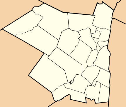
Ulster County, New York facts for kids
Quick facts for kids
Ulster County
|
|||
|---|---|---|---|
|
|||
|
|||
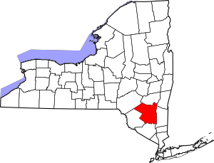
Location within the U.S. state of New York
|
|||
 New York's location within the U.S. |
|||
| Country | |||
| State | |||
| Founded | November 1, 1683 | ||
| Named for | Prince James, Duke of York and Albany and Earl of Ulster | ||
| Seat | Kingston | ||
| Largest city | Kingston | ||
| Area | |||
| • Total | 1,161 sq mi (3,010 km2) | ||
| • Land | 1,124 sq mi (2,910 km2) | ||
| • Water | 37 sq mi (100 km2) 3.1% | ||
| Population
(2020)
|
|||
| • Total | 181,851 |
||
| • Density | 160/sq mi (60/km2) | ||
| Time zone | UTC−5 (Eastern) | ||
| • Summer (DST) | UTC−4 (EDT) | ||
| Congressional districts | 18th, 19th | ||
Ulster County is a place in New York State. It's located along the Hudson River. In 2020, about 181,851 people lived here. Kingston is the main city, also called the county's capital. The county got its name from Ulster, a region in Ireland. It's part of New York's beautiful Hudson Valley region.
Contents
Discovering Ulster County's Past
How Ulster County Began
Long ago, this area was part of a Dutch colony called New Netherland. Dutch traders called it "Esopus." This name came from a local word meaning "land of flowing water and high banks." There's still a town called Esopus in Ulster County today.
The native people here were the Lenape. The Dutch called them "Esopus Indians." In 1652, a farmer named Thomas Chambers bought land in Esopus. He and others started farming there in 1653. Their small settlements grew into a village called Wiltwijck. Later, the English renamed it Kingston.
In 1683, the Duke of York created 12 counties. One of them was Ulster County. It was named after Prince James, who was also the Duke of York and Earl of Ulster. He later became King James II of England. Back then, Ulster County was much bigger. It included parts of what are now Sullivan, Delaware, Orange, and Greene counties.
In 1777, Kingston became the first capital of the independent New York State. When the British planned to burn Kingston, Ulster County's important records were moved to a safe stone house in Kerhonkson.
Over the years, parts of Ulster County were used to create other counties:
- In 1797, parts of Ulster and Otsego counties formed Delaware County.
- In 1798, some southern towns moved to Orange County.
- In 1800, parts of Ulster and Albany counties formed Greene County.
- In 1809, Sullivan County was created from Ulster County.
Ulster County During the Civil War
During the American Civil War, many volunteers from Ulster County joined the army. They formed a large part of these regiments:
- 80th New York Volunteer Infantry Regiment
- 120th New York Volunteer Infantry
- 156th New York Volunteer Infantry
Other groups with soldiers from Ulster County included:
- 1st Battalion New York Volunteer Sharpshooters
- 1st New York Volunteer Engineer Regiment
- 7th Regiment New York Volunteer Cavalry
- 7th New York Veteran Infantry Regiment
- 20th New York Volunteer Infantry Regiment
- 25th New York Volunteer Infantry Regiment
- 56th New York Volunteer Infantry
- 65th New York Volunteer Infantry
- 71st New York Infantry
- 102nd New York Volunteer Infantry
- 132nd New York Volunteer Infantry Regiment
- 168th New York Volunteer Infantry
- 176th New York Volunteer Infantry
- 178th New York Volunteer Infantry Regiment
Ulster County in the 1900s
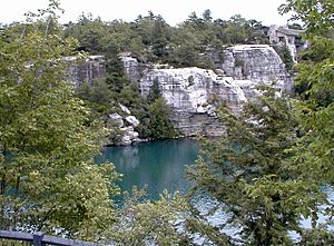
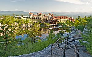
The Lake Mohonk Mountain House is a famous hotel on Shawangunk Ridge. It was recognized as a special historic place in 1986.
Exploring Ulster County's Geography
Ulster County covers about 1,161 square miles. Most of this is land (1,124 square miles). The rest (37 square miles) is water, like rivers and lakes.
The county is in southeastern New York State. It's south of Albany and west of the Hudson River. Much of the county is covered by the Catskill Mountains and the Shawangunk Ridge.
Ulster County has many beautiful parks and forests. These include Minnewaska State Park Preserve, Mohonk Preserve, Sundown State Park, and several state forests. Minnewaska State Park is home to rare dwarf pine trees and the stunning Verkeerder Kill falls.
The highest point in the county is Slide Mountain. It's about 4,180 feet above sea level. The lowest point is at sea level along the Hudson River.
Neighboring Counties
Ulster County shares borders with these other counties:
- Greene County to the north
- Columbia County to the northeast
- Dutchess County to the southeast
- Orange County to the south
- Sullivan County to the southwest
- Delaware County to the northwest
Protected Natural Areas
The Shawangunk Grasslands National Wildlife Refuge is a special area in Ulster County. It helps protect wildlife and their habitats.
People of Ulster County
| Historical population | |||
|---|---|---|---|
| Census | Pop. | %± | |
| 1790 | 29,370 | — | |
| 1800 | 24,855 | −15.4% | |
| 1810 | 26,576 | 6.9% | |
| 1820 | 30,934 | 16.4% | |
| 1830 | 36,550 | 18.2% | |
| 1840 | 45,822 | 25.4% | |
| 1850 | 59,384 | 29.6% | |
| 1860 | 76,381 | 28.6% | |
| 1870 | 84,075 | 10.1% | |
| 1880 | 85,838 | 2.1% | |
| 1890 | 87,062 | 1.4% | |
| 1900 | 88,422 | 1.6% | |
| 1910 | 91,769 | 3.8% | |
| 1920 | 74,979 | −18.3% | |
| 1930 | 80,155 | 6.9% | |
| 1940 | 87,017 | 8.6% | |
| 1950 | 92,621 | 6.4% | |
| 1960 | 118,804 | 28.3% | |
| 1970 | 141,241 | 18.9% | |
| 1980 | 158,158 | 12.0% | |
| 1990 | 165,304 | 4.5% | |
| 2000 | 177,749 | 7.5% | |
| 2010 | 182,493 | 2.7% | |
| 2020 | 181,851 | −0.4% | |
| U.S. Decennial Census 1790–1960 1900–1990 1990–2000 2010–2020 |
|||
In 2010, Ulster County had about 181,440 people. There were 67,499 households. Most people (83.2%) were white. About 6.5% were Black or African American. About 7.6% of the population was Hispanic or Latino.
Many people in Ulster County have European roots. For example, 19.2% have Italian backgrounds. Also, 16.8% have Irish roots, and 15.5% have German roots. Most people (90.3%) speak English at home.
In 2010, about 23.5% of the population was under 18 years old. The average age was 38 years.
2020 Census Information
In 2020, the population of Ulster County was 181,851.
| Race | Num. | Perc. |
|---|---|---|
| White (non-Hispanic) | 136,695 | 75.16% |
| Black or African American (non-Hispanic) | 10,152 | 5.8% |
| Native American (non-Hispanic) | 306 | 0.2% |
| Asian (non-Hispanic) | 3,778 | 2.1% |
| Pacific Islander (non-Hispanic) | 45 | 0.02% |
| Other/Mixed (non-Hispanic) | 9,756 | 5.4% |
| Hispanic or Latino | 21,119 | 11.61% |
Fun Things to Do in Ulster County
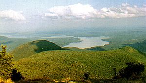
Ulster County is a popular place for vacations. It has many outdoor areas to explore. These include the Catskill Mountains, the Hudson River, Minnewaska State Park, Catskill Park, and the Shawangunk Mountains. You can enjoy activities like hiking, biking, skiing, horseback riding, kayaking, and rock climbing. You can also go hunting and fishing.
The county has over 40 miles of "rail trails." These are old railroad lines turned into paths for walking and biking. They include the Hudson Valley Rail Trail and the Wallkill Valley Rail Trail. The Walkway Over the Hudson is the world's longest pedestrian bridge. It crosses the Hudson River and connects to trails in Ulster County.
Ulster County has also played a part in important U.S. history. The Senate House State Historic Site in Kingston, New York is where American colonists met in 1777. They created the first New York Constitution there.
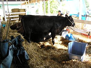
The Ulster County Fair is a fun event held in New Paltz. It's known as "The Best Six Days of Summer." The county also has recreation spots like the Ulster County Pool in New Paltz and Ulster Landing Park in Saugerties.
For sports fans, Kingston Stockade FC is a semi-professional soccer team. They play in Kingston at Dietz Stadium. The Saugerties Stallions are a summer baseball team. They play in Saugerties and won a championship in 2021.
Getting Around Ulster County
You can travel in Ulster County using public buses. Trailways of New York offers routes to New York City and Albany. Ulster County Area Transit provides local bus service.
Main Roads in Ulster County
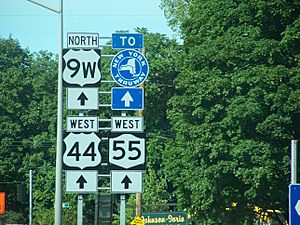
The New York State Thruway (I-87) runs through the county. It connects New York City to Albany. Other important roads include NY 55, NY 52, and NY 28 (east-west). US 209, US 9W, and NY 32 are major north-south roads.
Towns and Villages in Ulster County
| Ulster County, New York |
|---|
|
|
City
- Kingston (This is the county's main city)
Towns
Villages
Census-Designated Places (CDPs)
These are areas that look like towns but are not officially incorporated.
- Accord
- Clintondale
- Cragsmoor
- East Kingston
- Gardiner
- Glasco
- High Falls
- Highland
- Hillside
- Hurley
- Kerhonkson
- Lake Katrine
- Lincoln Park
- Malden-on-Hudson
- Marlboro
- Milton
- Napanoch
- Phoenicia
- Pine Hill
- Plattekill
- Port Ewen
- Rifton
- Rosendale
- Ruby
- Saugerties South
- Shokan
- Stone Ridge
- Tillson
- Walker Valley
- Wallkill
- Watchtower
- West Hurley
- Woodstock
- Zena
Hamlets
Hamlets are smaller communities that are part of a town.
- Bearsville
- Big Indian
- Bloomington
- Boiceville
- Brown's Station
- Centerville
- Chichester
- Cottekill
- Kaatsbaan
- Krumville
- Lew Beach
- Modena
- Mt. Pleasant
- Mt. Tremper
- Olivebridge
- Oliverea
- Palentown
- Samsonville
- Seager
- Shady
- Spring Glen
- Sundown
- Tabasco
- West Park
- West Saugerties
- West Shokan
- Willow
Schools in Ulster County
Ulster County has many school districts. Here are some of them:
- Ellenville Central School District
- Fallsburg Central School District
- Highland Central School District
- Kingston City School District
- Livingston Manor Central School District
- Margaretville Central School District
- Marlboro Central School District
- New Paltz Central School District
- Onteora Central School District
- Pine Bush Central School District
- Rondout Valley Central School District
- Saugerties Central School District
- Tri-Valley Central School District
- Valley Central School District (Montgomery)
- Wallkill Central School District
Images for kids
See also
 In Spanish: Condado de Ulster para niños
 | Selma Burke |
 | Pauline Powell Burns |
 | Frederick J. Brown |
 | Robert Blackburn |


