Slide Mountain (Ulster County, New York) facts for kids
Quick facts for kids Slide Mountain |
|
|---|---|
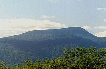
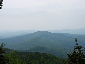
Slide Mountain from Ashokan High Point
|
|
| Highest point | |
| Elevation | c. 4,180 feet (1,270 m) |
| Prominence | 3,300 ft (1,000 m) |
| Listing |
|
| Geography | |
| Location | Shandaken, New York, U.S. |
| Parent range | Burroughs Range |
| Topo map | Peekamoose Mountain |
| Climbing | |
| First ascent | unknown |
| Easiest route | trail |
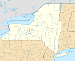
Slide Mountain is the tallest peak in the Catskill Mountains in New York State, USA. It is found in the town of Shandaken in Ulster County. Maps usually show its height as about 4,180 feet (1,274 meters). However, its exact height has never been officially measured by the U.S. Coast and Geodetic Survey. Many unofficial measurements suggest it might be even taller, possibly over 4,200 feet (1,280 meters) above sea level.
Even though it wasn't known as the highest peak until the late 1800s, Slide Mountain has played a big part in the Catskills' history. Famous nature writer John Burroughs wrote about his climbs up Slide. The mountain also helped get the Catskills included in New York's Forest Preserve. A special bird, the Bicknell's thrush, was first found on its top.
Contents
Mountain Features and Location
Like most Catskill peaks, Slide Mountain has a gentle, rounded top. It forms a narrow ridge that gets wider on its eastern side. From there, the mountain slopes steeply down to the low point, called a col, that connects it to Cornell Mountain.
On the western side, a wide slope, part of the Catskill Divide, goes down to the gap between Slide and Hemlock Mountain. This area is also near Winnisook Lake, where the Esopus Creek begins.
Two other clear ridges extend from the mountain. One goes southwest towards Wildcat Mountain. The other goes north towards Giant Ledge.
Both upper parts of the Neversink River start on the slopes of Slide Mountain.
Slide Mountain is also the highest point in several important areas:
- Ulster County.
- The Delaware River watershed, which is the area of land where all water drains into the Delaware River.
- All of New York State outside the Adirondack High Peaks region.
- A 300-kilometer (186.5-mile) radius around New York City. Slide is about 90 miles (145 km) north/northwest of Manhattan.
It is also the most southern peak in the Northeast that is taller than 4,000 feet (1,219 meters). The Appalachians don't reach this height again until West Virginia.
Mountain History
Discovering the Highest Peak
It took a long time for Slide Mountain to be recognized as the highest peak in the Catskills. This is surprising for a mountain with so many special features.
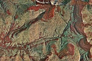
The mountain got its name from a landslide that happened in 1819 on its north side, near the top. You can still see the scar from this slide today. Another slide in 1982 made the scar even bigger.
Slide Mountain was not confirmed as the highest peak until 1886. This was much later than other mountain ranges in the Northeast had been surveyed. Because of old land disagreements, a full and fair survey of the Catskill region hadn't been done until then.
Seven years earlier, Princeton geology professor Arnold Henry Guyot became interested in the Catskill Mountains. He was staying at the Catskill Mountain House. The hotel claimed that nearby Kaaterskill High Peak was the highest. Professor Guyot did his own survey. He found that Slide Mountain, located southwest, was much taller than any other peak in the range. Hotel owners around North–South Lake strongly disagreed until others confirmed his findings.
Once its status was confirmed, some people wanted to give Slide a more important name, like "Mount Lincoln." But Guyot preferred "Slide" because he had used local names for other peaks in his survey.
Many stories grew about how the highest peak was discovered so late. One story says a new owner of Hunter Mountain tried to prove his mountain was the highest. Another story tells of John Burroughs proving it by having friends aim a rifle from the top of Slide.
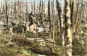
After Slide's status was confirmed, tourism shifted to the new highest peak. A local woodsman named Jim Dutcher knew the mountain well. He used to collect hemlock bark for tanning. In 1880, he built a hotel and a trail to the summit. He regularly guided visitors up the mountain. His trail is now on private land and has been unused since 1941, except for the last part to the summit. But you can still find parts of it.
Creating the Forest Preserve
Around the same time, Slide Mountain helped create New York's Forest Preserve.
Some private lands near the mountain had lost all their value. This happened because tanners didn't pay their property taxes and left the area. When the county took over these lands, it had to guarantee state property taxes.
Many local voters and landowners felt cheated. Ulster County refused to pay, even after a court order. Their representatives in Albany found a solution. The lands were given to the state as part of the new Forest Preserve. This preserve was first meant only for the Adirondacks. This agreement helped Ulster County pay its debts to the state. This was the start of what became the Catskill Park.
On June 11, 1886, a group from the state's forest commission climbed Slide Mountain. They wanted to officially recognize the peak and the Catskill Forest Preserve. They used Dutcher's trail, but he didn't join them. He was a Republican, and the commissioners were appointed by Democratic governor David Hill. Still, the group reached the top. Townsend Cox, the head of the commission, said the view was as good as any in the Adirondacks.
The next year, the state used 200 acres (80 hectares) on the mountain's west slope to bring back white-tailed deer. Deer numbers had dropped a lot. A 10-foot (3-meter) wooden fence was built to protect them from poaching. Eventually, 95 deer were released, successfully bringing the species back.
Today, there are actually few deer in that area. The old forest doesn't have much of the young plants deer like to eat. Also, predators like black bears have become more common.
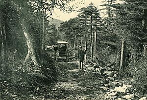
In 1892, the new laws helped Slide achieve an important first. The state spent $250 to build a trail up the west side of the mountain. This was the first trail built with public money in the Forest Preserve. They also checked if it was on public land. Even though it wasn't, the trail was built anyway.
This trail is still used today as part of the Burroughs Range Trail. It is rocky and has been eroded, but it is the most popular way to climb the mountain.
Two years later, the Forest Preserve laws were added to New York's constitution as Article 14.
John Burroughs and His Writings
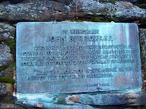
John Burroughs made Slide Mountain famous. He could often see the peak from his childhood home in Delaware County. He said it looked like a horse grazing from behind.
He tried to climb the mountain many times with friends. His story about successfully reaching the top from nearby Woodland Valley, called "The Heart of the Southern Catskills," is one of his best works. He wrote about the view from the summit:
- We saw the world as the hawk or the balloonist sees it when he is three thousand feet in the air. How soft and flowing all the outlines of the hills and mountains beneath us looked! The forests dropped down and undulated away over them, covering them like a carpet ...
- All was mountain and forest on every hand. Civilization seemed to have done little more than to have scratched this rough, shaggy surface of the earth here and there. In any such view, the wild, the aboriginal, the geographical greatly predominate. The works of man dwindle, and the original features of the huge globe come out. Every single object or point is dwarfed; the valley of the Hudson is only a wrinkle in the earth's surface. You discover with a feeling of surprise that the great thing is the earth itself, which stretches away on every hand so far beyond your ken.
The phrase "Here the works of man dwindle" was put on a plaque near the summit. The Winnisook Club placed it there after Burroughs died in 1921. It is on a ledge that offers the best view from the mountain. This spot is now known as Burroughs Ledge.
Eugene Bicknell and the Thrush
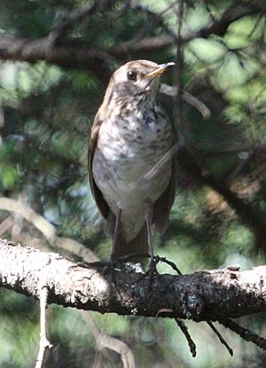
Another early visitor was Eugene Bicknell, an amateur ornithologist (bird expert) from Brooklyn. One day, he caught a small brown thrush bird near the summit. He couldn't identify it as any known species at the time.
The bird was first called the Slide Mountain thrush. Later, it was named Bicknell's thrush when it was found living in the high boreal forests of other Northeastern mountains. For a long time, scientists thought it was just a type of gray-cheeked thrush. But in the late 1900s, new research methods like DNA comparisons proved it was a separate species. This led to efforts to save its habitat and learn more about it.
Early 1900s Changes
The trail built in 1892 was meant to help people reach lookout towers on the mountain's summit. Visitors found that views from the top were blocked by trees. The state wanted the towers for fire control.
Even though the peak was important for creating the Catskill Forest Preserve, much of the land was still privately owned. The state bought more land in 1900. But it wasn't until 1928 that the state actually owned the summit and much of the land where the trail was built.
During World War II, a small military training plane crashed on the mountain's east slope. Most of the plane parts are gone, but you can still reach the crash site by a short path from the Burroughs Range Trail.
Slide Mountain Wilderness Area
In the mid-1960s, the Catskill Mountain 3500 Club was formally organized. This group encouraged hikers to climb mountains. Members had to climb Slide Mountain at least twice: once in winter and once during the rest of the year.
Around the same time, the Long Path hiking trail was routed over the mountain. The summit of Slide Mountain is still the highest point on the entire Long Path.
A big change in how the mountain was managed happened in the mid-1970s. The state's Conservation Commission became the Department of Environmental Conservation (DEC). They decided to create a plan for all Catskill lands. Slide Mountain gave its name to the state-designated Slide Mountain Wilderness Area. This is the largest wilderness area in the Catskills, covering 47,500 acres (190 square kilometers). New rules also stopped campers from misusing the summit.
For many years, the first two miles (3 km) of the trail up Slide crossed land owned by the nearby Winnisook Club. There was a metal gate across the Burroughs Range Trail marking the property line. Almost every tree below it had a "No Trespassing" sign. Because more people were hiking in the 1970s, parking near Winnisook Lake became a problem.
In the late 1970s, the New York State Department of Environmental Conservation (NYSDEC) solved this. They bought the land south of the ridgeline from the Winnisook Club. This made almost all of the trail public land. Then, they built a new parking lot further south on Ulster County Road 47. They moved the trail to start from this new public land and parking lot. This new section was part of the Phoenicia-East Branch Trail.
This new trail section requires crossing the west branch of the Neversink River at the start. Usually, you can cross using stepping stones. But in high water, the creek can be dangerous and impossible to cross.
Natural Environment
Forests on Slide Mountain
Slide Mountain's slopes are covered with typical Catskills hardwood forests. At lower elevations, you'll find different kinds of maple trees, yellow birch, and beech trees. Higher up, there's a boreal forest mainly made of balsam fir. You can find paper birch where these two types of forests meet.
Catskill forest researcher Michael Kudish found a special group of sugar maple trees. They are at about 3,900 feet (1,189 meters) high, near the western end of the mountain's summit ridge. This is unusual for sugar maples at such a high elevation.
He also noticed that Slide's boreal forest does not have any red spruce trees. This is different from other Catskill High Peaks. He believes there never have been any red spruce trees there. However, some groups of red spruce trees can be found at lower elevations on the mountain.
Mountain Geology
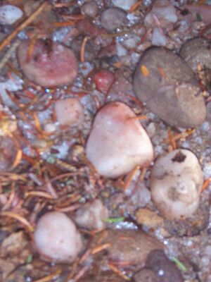
One interesting feature of Slide Mountain is the white quartz pebbles found on the trail along the summit ridge. They make the path feel like a garden.
These pebbles are not found anywhere else in the Catskills. It's thought that they wouldn't have survived the Wisconsin glaciation (a period when glaciers covered much of North America). This has led some to believe that Slide's summit might have been a nunatak during that time. A nunatak is a mountain peak that sticks out above the ice. However, one researcher reported finding glacial striations (scratches from glaciers) on rocks near the summit. This suggests glaciers did cover the top. These marks have worn away over time, making them hard to confirm. Now, most experts think they might have been left by glaciers during an earlier ice age, the Illinoian Stage.
Ways to Reach the Summit
You can reach the summit of Slide Mountain by following marked trails or by finding your own way through the woods (called "bushwhacking"). To protect the high-elevation forests, DEC rules do not allow camping above 3,500 feet (1,067 meters) in the Catskills. This rule applies except between December 21 and March 21. Open fires are not allowed in these areas all year.
Main Hiking Trails
Three trails combine to offer three possible ways to climb the mountain. Only one trail goes directly over the summit.
Burroughs Range Trail from the West
The most common way to climb Slide Mountain is from the west. The starting point for this trail is already at a high elevation, which means less climbing is needed. Moving the trailhead from Winnisook Lake to the new state parking lot added a little to the climb. But it's still less than climbing some lower Catskill High Peaks.
After crossing the upper west branch of the Neversink River at the trailhead (2,400 feet or 731.5 meters high), the yellow-blazed P-EB trail gently goes uphill. It crosses some smaller streams for about 0.7 miles (1 km). Then it reaches the old carriage road it used to follow through the Winnisook Club property. It follows this road south for 0.3 miles (500 meters) past a reliable spring. Here, it meets the red-blazed Burroughs Range Trail, which is the old horse trail built in 1892.
This trail steadily climbs Slide's southwest ridge for about a mile to the summit ridge. Here, the boreal forest begins. The trail then turns sharply north, then west again, following the north side of the summit ridge. Soon after this turn, the old Dutcher Trail, marked by very faded orange blazes, joins from the north. The rest of this section, with its white quartz pebbles, is the trail Dutcher built and used.
An official trail, the Curtis-Ormsbee (see below), soon joins from the south. At this point, the Long Path also joins the trail. From here, it's 0.7 miles (1 km) to the summit. You'll find views to the north at several spots along the way. One view is just before the summit, above the landslides that gave the mountain its name.
The total distance for this route is 2.75 miles (4.4 km). The climb is about 1,700 feet (518 meters) up.
Curtis-Ormsbee Trail
Starting from the same point, the Curtis-Ormsbee Trail adds more distance to the trip. But it's a favorite for serious hikers because it offers another viewpoint and goes through beautiful parts of the forest. This is the route the Long Path takes up the peak.
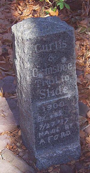
It is named after William Buckingham Curtis and Allan Ormsbee. They were two hikers from New York who died in a sudden snowstorm in the Presidential Range of New Hampshire's White Mountains in 1900. They had planned this trail. A small monument to them is at the trail's southern end. It leaves the Phoenicia-East Branch Trail 0.8 miles (1.2 km) south of the Burroughs Range Trail junction. This is in the col between Slide and Wildcat Mountain.
The blue-blazed trail is 1.6 miles (2.6 km) long. It follows another ridge up to where it meets the Burroughs Range Trail on the summit ridge. Just above the signs about camping and fire rules (put in place by NYSDEC to protect the forests), there are two viewpoints. One looks out at Table and Lone mountains. The other offers the only good view of the lowest High Peak, the remote and challenging Rocky Mountain. The trail continues to the summit through long, fragrant areas of balsam fir. Some parts are muddy, needing puncheon bridges to cross.
It is 4.1 miles (6.6 km) to the summit using this route. Many hikers make a loop trip if they have time. They go up the Curtis-Ormsbee Trail and come down the Burroughs Range Trail. This is a total trip of 6.85 miles (11 km).
You can also reach the start of the Curtis-Ormsbee Trail by using the Long Path approach. This means coming from the southern end of the Phoencia-East Branch Trail, which is 2.95 miles (4.7 km) away in the town of Denning. The vertical climb to the summit using this route is almost 2,000 feet (609 meters). The total distance to the summit is 6.25 miles (10.1 km).
Burroughs Range Trail from the East
The hardest way to reach the summit of Slide Mountain starts at the eastern end of the Burroughs Range Trail. This is at Woodland Valley State Campground south of Phoenicia. This route covers the whole range, going over Wittenberg and Cornell mountains. It's a 7-mile (11.2-km) climb with a 2,700-foot (823-meter) rise. Wittenberg and Cornell are tough climbs on their own. The final challenge is the steep 900-foot (274-meter) east slope of Slide.
Many hikers do this as an overnight backpacking trip. The long col between Slide and Cornell has a spruce grove that is a great place to camp. The state has marked several campsites in that area. Some hikers, however, have managed to reach the summit of Slide and return to Woodland Valley in one very long day. They often go down to the western trailhead and follow the Phoenicia-East Branch trail back. This grand loop is 13.95 miles (22.5 km) long.
Off-Trail Routes (Bushwhacks)
Two routes that are at least partly off-trail have been used by hikers looking for a bigger challenge.
The North Ridge
The ridge that goes down from the summit to the col with Giant Ledge to the north is a clear route. The DEC once planned a trail here. But hikers and hunters disagreed, and the route was considered too sensitive for a trail.
You can start this route from the Giant Ledge trailhead. This is at a sharp turn on County Road 42, about 2,200 feet (670.5 meters) high. It's 0.65 miles (1 km) to the blue-blazed Fox Hollow Trail junction. This trail leads north to Giant Ledge and Panther Mountain. If you go directly south from this junction, you will soon start climbing the north ridge. You'll first reach a 3,620-foot (1,103.3-meter) summit (on private land of the Winnisook Club). Then, you turn southeast through a thickening boreal forest to the 3,800-foot (1,158-meter) summit. From there, the narrow, heavily forested ridge leads steeply up to the summit ridge and the Burroughs Range Trail, about 0.25 miles (400 meters) from the summit.
East Branch of the Neversink River
This is a long route that very ambitious hikers have used. It's often part of multi-day trips to climb the off-trail peaks southeast of Slide. This route follows the east branch of the Neversink River up to the ridge connecting Slide and Cornell.
Starting from the Denning trailhead, follow the P-EB Trail for 1.1 miles (1.8 km). It meets the blue-blazed Peekamoose-Table Trail, which drops east for 0.35 miles (560 meters) into the river valley. This is near the Deer Shanty Brook where there are many river channels. Some of these can be hard to cross in high water. After one of the last crossings, you can find the start of the "Fisherman's Path." This is an unofficial trail that follows the East Branch far upstream into the wildest part of the Catskills.
It takes skill to follow this trail. Red paint blazes sometimes appear but are often painted over by DEC forest rangers. While it's sometimes wide and clear, it's not always easy to follow. It also switches sides of the river several times.
Further upstream, as it passes the usual starting points for Lone, Rocky, Balsam Cap, and Friday mountains, the path becomes less used and harder to follow. The challenge of hiking Slide this way is not the mountain itself, but finding your way when the trail starts to climb to the col.
Deer Shanty Brook
The most challenging off-trail route is the rarely attempted approach up this small river that flows into the East Branch. It starts the same way as the East Branch route. But it involves leaving the trail at that crossing and following the brook to the slopes of Slide to the southeast. There is no trail at all through this area. The boreal forest on this part of the mountain is said to be very difficult to get through, even compared to other nearby peaks.
The Summit of Slide Mountain
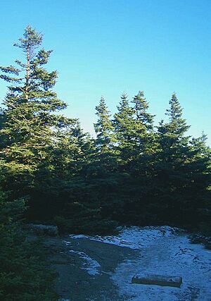
The very top of the mountain is a small clearing with no views. You can see the foundations of old towers that once stood there.
Just to the west, however, is the much wider clearing of Burroughs Ledge. This spot offers a wide view to the east. The Ashokan Reservoir is easy to see, and you might even spot the Kingston-Rhinecliff Bridge. The nearby high peaks to the east look like small hills. The Devil's Path and Blackhead Range in Greene County are visible to the north. In fact, from different spots along the summit ridge, you can see almost all of the other 34 Catskill High Peaks.
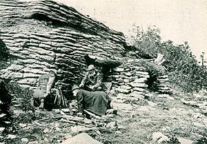
At one time, the view was even wider. But since camping on the summit is now banned (except in winter and emergencies), the balsam fir trees have grown back around the edges of the clearing. This gives the area a more natural look. If you look closely, you can still find parts of the two lean-to shelters that were there before 1975 when camping was allowed. There is also a spring about 0.25 miles (400 meters) down the trail to the east.
On June 15, 1985, Slide Mountain's summit had its most visitors ever at one time. At least a hundred hikers, nature lovers, and DEC officials gathered there. They were celebrating 100 years of the Forest Preserve. Similar numbers of visitors came in 2004 when the Catskill Park itself reached a similar milestone.
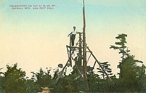
Summit Towers
Because there isn't a clear 360-degree view from the top of Slide Mountain, several observation towers have been built there over the years.
Jim Dutcher likely built a simple tower from balsam logs. John Burroughs mentioned it in his writings. It was still there in 1900 when another visitor saw it.
The state wanted to use the mountain's height for fire control. In 1911, they built a more permanent fire lookout tower and a cabin for an observer on the summit. But it was only used for one year, then abandoned.
Steel for a more permanent tower was brought to the summit in the early 1930s. But the tower itself wasn't built until wartime. It was taken down around 1965, and no new one has been built.
In the late 1990s, the DEC updated the plan for the Slide Mountain Wilderness Area. They thought about rebuilding an observation tower at the summit to bring back the missing views. However, even with the history of towers, the rules for wilderness areas at that time led to the idea being rejected.
|
 | Bayard Rustin |
 | Jeannette Carter |
 | Jeremiah A. Brown |


