Neversink River facts for kids
Quick facts for kids Neversink River |
|
|---|---|

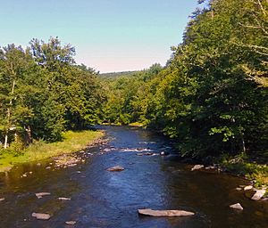
The Neversink at Oakland Valley
|
|

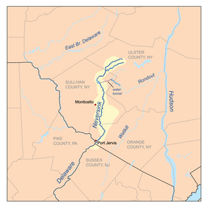
The Neversink and its two branches
|
|
| Country | United States |
| State | New York |
| Counties | Orange, Sullivan |
| City | Port Jervis |
| Physical characteristics | |
| Main source | East Branch Neversink River S of col between Slide and Cornell mountains, Town of Shandaken, Ulster County 2,960 ft (900 m) 41°59′40″N 74°22′21″W / 41.99444°N 74.37250°W |
| 2nd source | West Branch Neversink River NW slope of Slide Mountain, Town of Shandaken 3,480 ft (1,060 m) 42°00′19″N 74°23′29″W / 42.00528°N 74.39139°W |
| River mouth | Delaware River Port Jervis, Orange County 400 ft (120 m) 41°21′24″N 74°41′43″W / 41.35667°N 74.69528°W |
| Length | 55 mi (89 km) |
| Discharge (location 2) |
|
| Basin features | |
| Basin size | 435 sq mi (1,130 km2) |
The Neversink River is a 55-mile-long (89 km) river in southeastern New York. It flows into the Delaware River. The name "Neversink" comes from an old Algonquian language phrase. It means "mad river," which might describe how fast it flows sometimes!
In the 1890s, a man named Theodore Gordon became very skilled at matching fishing flies to real insects. Another person, Edward Ringwood Hewitt, studied insects and flies near the town of Neversink. Because of their work, many people believe the Neversink River is where American dry fly fishing first started.
Contents
Where the Neversink River Flows
The Neversink River starts where its two main parts, the East and West Branches, meet. This happens near the small town of Claryville. Both branches begin high up on the slopes of Slide Mountain. This mountain is the tallest peak in the Catskills.
The West Branch and Its Journey
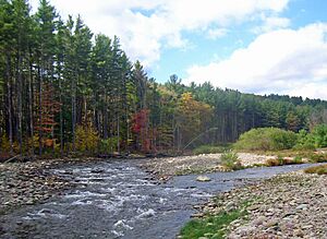
The West Branch of the Neversink River is joined by other streams like Biscuit Brook. In its upper parts, the river is wild and rocky. This makes it a great place for trout fishing. However, much of the land along the river is privately owned. This means it is not open for public fishing.
The Neversink Reservoir
The river generally flows southwest through the mountains. Not far from where the two branches join, the river is stopped by a dam. This dam creates the Neversink Reservoir. This reservoir is an important part of the New York City Water Supply System. A 5-mile (8 km) tunnel connects it to another reservoir, the Rondout Reservoir.
Building the Neversink Reservoir meant that many local towns and homes were flooded. People living there had to move. New York City paid for their relocation.
Journey to the Delaware River
The Neversink River flows through several towns and hamlets. These include Fallsburg, Woodbourne, and South Fallsburg. It then enters the town of Thompson. The Route 17 highway crosses the river here.
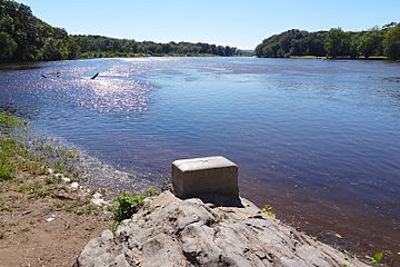
Further south, the river passes over its largest waterfalls. These are Denton Falls and High Falls, found in the Neversink Gorge. The river then flows southeast into Orange County. Near Cuddebackville, another stream called Basher Kill joins it. Finally, the Neversink River meets the Delaware River at Port Jervis. At this meeting point, the Tri-States Monument marks where New York, New Jersey, and Pennsylvania all meet.
Fun Activities on the Neversink River
The Neversink River is a very popular place for trout fishing. This is especially true north of Woodbourne. You can find several types of trout here. These include rainbow trout, brown trout, brook trout, and the rare tiger trout. The river is also home to other fish like smallmouth bass, carp, and American eel. Many different plants and animals live along the river too.
Other River Activities
Other fun activities are not as common on the Neversink River. There are a few places where you can swim. However, many of these spots are on private land or restricted public areas. The river is quite narrow, so it's not ideal for large boats. Small boats can travel on the river from the dam near Hasbrouck down to its mouth. But, not many people do this.
In the late 1800s, people said you could even travel by boat all the way to Claryville. There was a tannery there that used the river to transport its products.
Historical Aqueduct Bridge
The Delaware and Hudson Canal once crossed the Neversink River near Cuddebackville. It used a special bridge called an aqueduct bridge. This bridge was designed by John Roebling and built in 1851.
History of the Neversink River

The Neversink River can sometimes flood, especially near where it meets the Delaware River. This happened in April 2005. It caused damage and forced people to leave their homes in the Port Jervis area. The Myers Grove community was especially affected.
Heavy rains combined with melting snow can also cause big floods. This often happens from January to April. When a lot of snow melts at the same time as heavy rain, the river's water level rises very quickly.
You can find more details about the river's history in a book called History of Sullivan County. It was written by James Eldrige Quinlan in 1873.
Streams Joining the Neversink
- Basher Kill
- Sheldrake Stream
- Eden Brook
- Mullet Brook
- Monell Brook
 | Shirley Ann Jackson |
 | Garett Morgan |
 | J. Ernest Wilkins Jr. |
 | Elijah McCoy |


