Neversink, New York facts for kids
Quick facts for kids
Neversink, New York
|
|
|---|---|

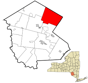
Location of Neversink in Sullivan County, New York
|
|
| Country | United States |
| State | New York |
| County | Sullivan |
| Area | |
| • Total | 86.26 sq mi (223.42 km2) |
| • Land | 82.77 sq mi (214.38 km2) |
| • Water | 3.49 sq mi (9.04 km2) |
| Elevation | 1,499 ft (457 m) |
| Population
(2020)
|
|
| • Total | 3,366 |
| • Density | 39.022/sq mi (15.0658/km2) |
| Time zone | UTC-5 (Eastern (EST)) |
| • Summer (DST) | UTC-4 (EDT) |
| ZIP code |
12765
|
| Area code(s) | 845 |
| FIPS code | 36-49847 |
| GNIS feature ID | 0979252 |
Neversink is a small town located in Sullivan County, New York, United States. In 2020, about 3,366 people lived there.
The Town of Neversink is in the northeastern part of Sullivan County. The Neversink River flows through the town. Many people believe this river is where American fly fishing first started!
Contents
History of Neversink
The town of Neversink was created in 1798. Back then, it was part of the Town of Rochester in Ulster County. Later, other towns like Rockland (in 1809) and Fallsburg (in 1826) were formed from parts of Neversink.
Communities Under Water
When the Neversink and Rondout reservoirs were built, some communities were covered by water. These reservoirs are an important part of New York City's water supply system. The old communities of Old Neversink and Bittersweet were lost to create the Neversink Reservoir. Eureka, Montela, and Lackawack were also covered to form the Rondout Reservoir.
Rules About Alcohol Sales
In 1935, the town made a rule that stopped stores from selling alcoholic drinks. This rule stayed in place for a long time. In 2015, the town changed the rule a little bit. Restaurants were allowed to sell alcohol, but convenience stores still could not.
Geography of Neversink
A part of Neversink is located within the beautiful Catskill Park. The northern and eastern edges of the town share a border with Ulster County.
The town covers a total area of about 86.4 square miles (223.42 square kilometers). Most of this area, about 82.9 square miles (214.38 square kilometers), is land. The rest, about 3.5 square miles (9.04 square kilometers), is water.
Population Information
2020 Census
According to the 2020 census, there were 3,366 people living in Neversink. There were 1,472 households and 854 families.
| Historical population | |||
|---|---|---|---|
| Census | Pop. | %± | |
| 1820 | 1,380 | — | |
| 1830 | 1,258 | −8.8% | |
| 1840 | 1,681 | 33.6% | |
| 1850 | 2,281 | 35.7% | |
| 1860 | 2,486 | 9.0% | |
| 1870 | 2,458 | −1.1% | |
| 1880 | 2,152 | −12.4% | |
| 1890 | 2,013 | −6.5% | |
| 1900 | 2,039 | 1.3% | |
| 1910 | 1,743 | −14.5% | |
| 1920 | 1,609 | −7.7% | |
| 1930 | 1,256 | −21.9% | |
| 1940 | 1,494 | 18.9% | |
| 1950 | 1,465 | −1.9% | |
| 1960 | 1,565 | 6.8% | |
| 1970 | 2,055 | 31.3% | |
| 1980 | 2,840 | 38.2% | |
| 1990 | 2,951 | 3.9% | |
| 2000 | 3,556 | 20.5% | |
| 2010 | 3,557 | 0.0% | |
| 2020 | 3,336 | −6.2% | |
Places in Neversink
Here are some of the communities and interesting spots you can find in the Town of Neversink:
- Aden – A small community, called a hamlet, in the northern part of the town.
- Bittersweet – This was a community that disappeared when the Neversink Reservoir was built.
- Bradley – A hamlet located on the southwestern side of the Neversink Reservoir. It's near the border of the Town of Liberty.
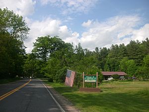
- Claryville – Another hamlet found near the northern border of the town.
- Curry – A hamlet situated to the west of Unionville.
- Eureka – This community is now covered by the waters of the Rondout Reservoir.
- Grahamsville – A hamlet located east of the main Neversink village, close to the Rondout Reservoir.
- Lowes Corners – A specific spot found north of the Rondout Reservoir.
- Neversink – This is the main hamlet of Neversink. It was built above the reservoir after the original community, sometimes called "Neversink Flats," was flooded by the Neversink Reservoir. You can find it on Route 55.
- Neversink Reservoir – A large reservoir that is located right in the middle of the town.
- Rondout Reservoir – Another reservoir that is partly located in the eastern area of the town.
- Unionville – A hamlet that is west of Grahamsville.
- Willowemoc – A hamlet near the western border of the town. It used to be known as "Willowcanoe."
Famous People from Neversink
- Conor Crickmore (born 1970) – An American farmer, teacher, and tool designer.
See also
 In Spanish: Neversink para niños
 | William M. Jackson |
 | Juan E. Gilbert |
 | Neil deGrasse Tyson |


