
Liberty, New York facts for kids
Quick facts for kids
Liberty, New York
|
|
|---|---|

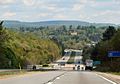
State Route 17 at Liberty (2008)
|
|
_highlighted.svg)
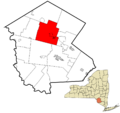
Location of the town of Liberty in Sullivan County, New York
|
|
| Country | United States |
| State | New York |
| County | Sullivan County |
| Area | |
| • Total | 80.74 sq mi (209.11 km2) |
| • Land | 79.58 sq mi (206.12 km2) |
| • Water | 1.16 sq mi (2.99 km2) |
| Population
(2020)
|
|
| • Total | 10,159 |
| • Density | 116.65/sq mi (45.04/km2) |
| Time zone | UTC-5 (Eastern (EST)) |
| • Summer (DST) | UTC-4 (EDT) |
| FIPS code | 36-105-42224 |
Liberty is a town located in Sullivan County, New York, United States. In 2020, about 10,159 people lived there. The town is crossed by major roads like NY 17, NY 52, and NY 55.
Contents
History of Liberty
The area of Liberty played a part in the American Revolutionary War. About 303 men from this town fought for independence. Liberty was once much larger, including areas that are now the Towns of Callicoon and Fremont. Today, the town covers about 85 square miles.
Early Settlers and Industries
The first settlers arrived in this area, known as the Blue Mountain country. They settled northwest of the current village, near what is now Revonah Lake. These early settlers came from Connecticut. Some of the oldest structures are stones placed in 1797 at Revonah Lake. These stones were likely used to build the first sawmill in the area.
As the dense hemlock forests were cleared, Liberty developed in stages. Early industries included tanneries, which operated through the American Civil War. After the Civil War, dairy farming became important. Later, people started taking in "summer boarders," which led to the building of large hotels like the Wawonda and Liberty House.
Around 1900, the Loomis Sanatorium was built to care for patients with tuberculosis (TB). Liberty became known for its fresh air and rest cures. Another sanatorium was built by the Workmen's Circle, a Jewish group. This property is now used by the County Home and Infirmary.
After new cures for TB were found, Liberty's economy relied more on tourism. Its natural beauty and closeness to big cities made it a popular summer destination.
Developing Communities
Over time, different settlements grew into the villages and hamlets we know today. Some old communities, like Doubtenville, Glen Cove, Egypt, and Red Brick, changed names or disappeared.
Today, the Town of Liberty includes the Village of Liberty and smaller hamlets. These hamlets are Ferndale, Parksville, Swan Lake, and White Sulphur Springs.
The Village of Liberty
The Village of Liberty was officially formed on September 17, 1870. It is the largest community in the town. It is located where Route 17 (the Quickway) and State Highway Route 52 meet.
Liberty was famous for its tanneries and the old Liberty Normal Institute, founded in 1847. It also had popular Coaching Day Parades and grand hotels in the early 1900s. The Liberty House was one of the biggest hotels. It hosted many important events, like Lincoln Dinners.
Parksville
Parksville is the only hamlet that kept its original name. Early settlers like the Martins and Halls arrived in 1804. Later, the Parks family became very active in the area. Their efforts led to the name Parksville. Otherwise, it might have been called "Martinsville."
White Sulphur Springs
White Sulphur Springs was first called Robertsonville. It was named after Bradley Robertson, who settled there in 1809. He later fought in the War of 1812.
This hamlet has always been a rural area. It once had many small dairy farms and a cheese factory. In the late 1800s and early 1900s, it had a busy hotel and boarding house business. The large White Sulphur Springs House hotel was built then. It was named after a Sulphur Spring. People believed its waters had health benefits.
In December 1890, Robertsonville officially changed its name to White Sulphur Springs. This change likely helped promote tourism. Many more hotels were built, and the summer business thrived for years.
Ferndale
Ferndale was originally known as Liberty Falls. Roswell Russell settled it in 1807. During the Civil War, it had busy tanneries. A tall brick chimney from one of these tanneries stood until the 1950s.
The NYO&W Railway changed the name from Liberty Falls to Ferndale. This was done because mail often got mixed up. The name Ferndale now covers a larger area than just the hamlet.
The famous Grossinger's Catskill Resort Hotel was located within Ferndale's boundaries. This huge resort started in 1914. The Grossinger family began by taking in a few summer boarders to help with costs.
Swan Lake
Swan Lake was first called Stevensville. It was named after the Stevens brothers. They built a large tannery there, which operated until about 1873.
Since the 1880s, the Swan Lake area has been known for its hotels and tourism. Many local farm girls found jobs there in the early 1900s. The lake has always had many fish, attracting people who enjoy fishing.
Alden S. Swan arrived from New York around 1895. By the time he died in 1917, he owned much of the land and all of the lake. The name was changed to Swan Lake in January 1927. The Swan estate was bought by Siegel and Kretchmer. The Siegels went on to build the Commodore and Stevensville Hotels. The Stevensville Hotel grew into a large resort run by the Dinnerstein family.
Liberty was a very popular tourist spot, especially with Grossinger's Catskill Resort Hotel and other "Borscht Belt" attractions. However, when these big hotels closed, the tourism lifestyle that made Liberty famous also ended.
Geography of Liberty
According to the United States Census Bureau, the town of Liberty covers about 80.7 square miles (209.0 km²). Most of this area, about 79.6 square miles (206.2 km²), is land. The remaining 1.1 square miles (2.8 km²) is water.
Communities within Liberty
- Cooley – A place near the northern border of the town.
- Ferndale (formerly Liberty Falls) – A small community south of Liberty village on Route 17. The Ferndale School, Manion's General Store, and Shelburne Playhouse are important historical buildings here.
- Grossinger – A community south of Liberty village on Route 17. This was once the location of the famous Grossinger's Catskill Resort Hotel.
- Liberty – The main village, located on Route 17.
- Loomis – A small community west of Liberty village.
- Parksville – A community north of Liberty village on Route 17. The Tefereth Israel Anshei Parksville Synagogue is a historic building here.
- Revonah Lake (formerly Brodhead Pond) – A lake northwest of Liberty village. This was likely where the first settlers in the town lived.
- Swan Lake (formerly Stevensville) – A community near the southern town border, located at the east end of a lake also called "Swan Lake."
- White Sulphur Springs (formerly Robertsonville) – A community in the southwest part of the town on Route 52. The Jewish Community Center of White Sulphur Springs is a historic building here.
Population Information
| Historical population | |||
|---|---|---|---|
| Census | Pop. | %± | |
| 2000 | 9,632 | — | |
| 2010 | 9,885 | 2.6% | |
| 2020 | 10,159 | 2.8% | |
| U.S. Decennial Census 2020 | |||
In 2020, the population of Liberty was 10,159 people. In 2000, there were 9,632 people living in the town. About 3,711 households and 2,263 families lived there. The population density was about 121 people per square mile.
In 2000, about 24.7% of the population was under 18 years old. About 16.8% were 65 years or older. The average age was 39 years.
Education
The Liberty Central School District serves the town. It has three schools in Liberty.
Catholic schools closest to Liberty include Our Lady of Mount Carmel Elementary School in Wallkill and St. John Elementary School in Goshen. St. Peter's Regional School, the last Catholic school in Sullivan County, closed in 2019.
Notable People from Liberty
- Allan Bérubé – A historian, activist, and author.
- Alan Gerry – The person who started Cablevision Industries.
- Robert Y. Grant – A Justice of the Peace and a member of the New York State Senate.
- Taylor Jardine – The lead singer for the bands Sainte and We Are The In Crowd.
- Zoe Leonard – A well-known artist.
- Maurice Martin – A professional Basketball Player.
- Kaseem Sinceno – A former NFL player who graduated from Liberty High School.
Liberty in Film
Liberty is the setting for two films:
- David Cross's film Hits.
- The 2018 drama Nancy.
Images for kids
-
State Route 17 at Liberty (2008)
-
Location of the town of Liberty in Sullivan County, New York
See also
 In Spanish: Liberty (pueblo) para niños
