Greene County, New York facts for kids
Quick facts for kids
Greene County
|
|||
|---|---|---|---|
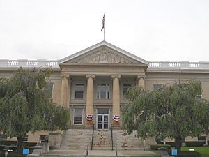
The Greene County Court House in Catskill, NY
|
|||
|
|||
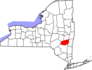
Location within the U.S. state of New York
|
|||
 New York's location within the U.S. |
|||
| Country | |||
| State | |||
| Founded | March 3, 1800 | ||
| Named for | Nathanael Greene | ||
| Seat | Catskill | ||
| Largest village | Catskill | ||
| Area | |||
| • Total | 658 sq mi (1,700 km2) | ||
| • Land | 647 sq mi (1,680 km2) | ||
| • Water | 11 sq mi (30 km2) 1.7% | ||
| Population
(2020)
|
|||
| • Total | 47,931 | ||
| • Density | 74.1/sq mi (28.6/km2) | ||
| Time zone | UTC−5 (Eastern) | ||
| • Summer (DST) | UTC−4 (EDT) | ||
| Congressional district | 19th | ||
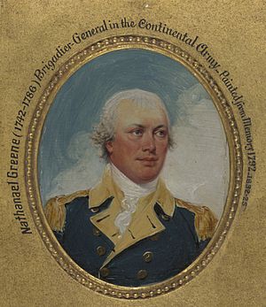
Greene County is a county in New York. In 2020, about 47,931 people lived there. The main town, or county seat, is Catskill. The county is named after Nathanael Greene, a famous general from the American Revolutionary War. Greene County is part of the Capital District area of New York State.
Contents
History of Greene County
Greene County was created on March 25, 1800. It was formed from parts of Albany County and Ulster County. At first, it covered about 630 square miles.
Over the years, the county's borders changed a few times. For example, in 1801, some land from Delaware and Ulster counties was added. This made Greene County larger. Later, in 1812, a small part of the county was given to Ulster County.
The county's borders were surveyed again several times. This helped make sure everyone knew where the county lines were. In 1822, Palenville was officially found to be inside Greene County. The final change happened in 1836, when some land was given to Schoharie County. This created the Greene County we know today.
Geography of Greene County
Greene County is in the southeastern part of New York State. It is located just west of the Hudson River and south of the city of Albany. The county covers about 658 square miles. Most of this area is land, with a small part being water.
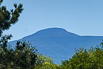
The northern and eastern parts of the county are mostly flat. Near the Hudson River, the land is at sea level. However, the southern and western areas rise sharply into the Catskill Mountains.
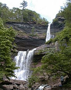
Catskill Park covers a large part of the south-central region. This park has some of the tallest mountains south of the Adirondacks. For example, Hunter Mountain is about 4,040 feet high. The park also has beautiful waterfalls, like the famous Kaaterskill Falls.
Greene County is part of New York's 19th Congressional District. This means its people are represented in the U.S. Congress by Republican Marc Molinaro.
Neighboring Counties
Greene County shares borders with several other counties:
- Albany County to the north
- Rensselaer County to the northeast
- Columbia County to the east
- Ulster County to the south
- Delaware County to the west
- Schoharie County to the northwest
Protected Areas
- Thomas Cole National Historic Site is a special area in Greene County.
Population and People
| Historical population | |||
|---|---|---|---|
| Census | Pop. | %± | |
| 1800 | 12,584 | — | |
| 1810 | 19,536 | 55.2% | |
| 1820 | 22,996 | 17.7% | |
| 1830 | 29,525 | 28.4% | |
| 1840 | 30,446 | 3.1% | |
| 1850 | 33,126 | 8.8% | |
| 1860 | 31,930 | −3.6% | |
| 1870 | 31,832 | −0.3% | |
| 1880 | 32,695 | 2.7% | |
| 1890 | 31,598 | −3.4% | |
| 1900 | 31,478 | −0.4% | |
| 1910 | 30,214 | −4.0% | |
| 1920 | 25,796 | −14.6% | |
| 1930 | 25,808 | 0.0% | |
| 1940 | 27,926 | 8.2% | |
| 1950 | 28,745 | 2.9% | |
| 1960 | 31,372 | 9.1% | |
| 1970 | 33,136 | 5.6% | |
| 1980 | 40,861 | 23.3% | |
| 1990 | 44,739 | 9.5% | |
| 2000 | 48,195 | 7.7% | |
| 2010 | 49,221 | 2.1% | |
| 2020 | 47,931 | −2.6% | |
| U.S. Decennial Census 1790-1960 1900-1990 1990-2000 2010-2020 |
|||
The population of Greene County has changed a lot over the years. In 1800, about 12,584 people lived there. The population grew steadily for many years. It reached its highest point in 2010 with 49,221 people. By 2020, the population was 47,931.
Who Lives in Greene County? (2020 Census)
The 2020 Census showed the different groups of people living in Greene County:
| Race | Number of People | Percentage |
|---|---|---|
| White | 39,494 | 82.4% |
| Black or African American | 2,159 | 4.5% |
| Native American | 100 | 0.21% |
| Asian | 500 | 1.04% |
| Pacific Islander | 3 | 0.01% |
| Other/Mixed | 2,566 | 5.4% |
| Hispanic or Latino | 3,109 | 6.5% |
Towns and Villages
Greene County has many different communities. These include towns, villages, and smaller places called hamlets.
Towns
Villages
- Athens
- Catskill (This is the county seat)
- Coxsackie
- Hunter
- Tannersville
Census-Designated Places
These are areas that are like towns but are not officially incorporated as one.
- Cairo
- Cementon
- East Durham
- Greenville
- Haines Falls
- Jefferson Heights
- Leeds
- New Baltimore
- Palenville
- Prattsville
- Round Top
- Sleepy Hollow Lake
- South Cairo
- West Kill
- Windham
Hamlets
Hamlets are small communities that are part of a larger town.
- Acra
- Cornwallville
- Climax
- Earlton
- Freehold
- Haines Falls
- Hannacroix
- Hensonville
- Lanesville
- Maplecrest
- Oak Hill
- Surprise
Notable People from Greene County
Many interesting people have come from Greene County:
- John Adams (1778–1854): Born in Oak Hill, he became a United States Congressman.
- Levi Hill: He claimed to be an early inventor of color photography.
- Blossom Dearie (1924-2009): A famous jazz singer.
- John B. Terry (1796-1874): Born in Coxsackie, he was a pioneer, merchant, and soldier. He also served in the Wisconsin territorial legislature.
- Thurlow Weed (1797-1882): Born in Acra, NY, he was a newspaper publisher and a powerful politician.
- Edwin L. Drake (1819-1880): Born in Greenville, he invented a way to drill for oil from the ground.
- Scott Adams: Born and raised in Windham, NY, he is an American cartoonist. He created the popular Dilbert comic strip.
See also
 In Spanish: Condado de Greene (Nueva York) para niños
 | Kyle Baker |
 | Joseph Yoakum |
 | Laura Wheeler Waring |
 | Henry Ossawa Tanner |


