
Windham (town), New York facts for kids
Quick facts for kids
Windham, New York
|
|
|---|---|
| Nickname(s):
"Land in the Sky",
"The Heart of the Catskills", "Gem of the Catskills" |
|

Location in Greene County and the state of New York
|
|
| Country | United States |
| State | New York |
| County | Greene |
| Government | |
| • Type | Town Council |
| Area | |
| • Total | 45.34 sq mi (117.42 km2) |
| • Land | 45.20 sq mi (117.07 km2) |
| • Water | 0.14 sq mi (0.35 km2) |
| Elevation | 1,893 ft (577 m) |
| Population
(2020)
|
|
| • Total | 1,708 |
| Time zone | UTC-5 (Eastern (EST)) |
| • Summer (DST) | UTC-4 (EDT) |
| ZIP code |
12496
|
| Area code(s) | 518 |
| FIPS code | 36-039-82480 |
| GNIS feature ID | 0979648 |
Windham is a small town located in Greene County, New York, United States. A town in New York is a type of local government area. In 2020, about 1,708 people lived there.
Many of the first people to settle in Windham came from Windham, Connecticut, or Windham County, Connecticut. This is likely why the town was given its name. Windham is also known by two cool nicknames: "Land in the Sky" and "Gem of the Catskills."
You can find Windham in the western part of Greene County. It sits right on the northern edge of the beautiful Catskill Park.
Contents
History of Windham
People first started settling in the Windham area around the year 1780. The town of Windham was officially created in 1798. At that time, it was part of Ulster County.
Over the years, as Greene County was formed, parts of Windham were used to create other towns. These new towns included Hunter and Lexington in 1813. Later, Prattsville was formed in 1833, and part of Ashland in 1848. By 1900, the population of Windham was around 1,240 people.
Windham Mountain and Local Economy
Today, a big part of Windham's income comes from the Windham Mountain ski resort. This resort used to be called "Ski Windham." Many skiers from the New York City area and other parts of the Northeast visit Windham Mountain.
Windham has also hosted exciting sports events. In August 2010, the town hosted the 2010 World Cup Mountain Bike Race. This was a big deal because it was the first time the finals of this race were held in the United States in 20 years! Windham hosted the race again in August 2014, as the only U.S. stop for the UCI Mountain Bike World Cup that year.
Hurricane Irene's Impact
In August 2011, Hurricane Irene caused a lot of damage in Windham. The storm brought over 10 inches of rain to the Batavia Kill creek in just a few hours. This led to a very serious flood in the area.
Geography and Climate
Windham covers a total area of about 45.4 square miles (117.6 square kilometers). Most of this area, about 45.3 square miles (117.3 square kilometers), is land. Only a small part, about 0.1 square miles (0.3 square kilometers), is water.
The town is located within the Catskill Mountains. A part of Windham is also inside the Catskill State Park. The Batavia Kill, which is a smaller stream that flows into the Schoharie Creek, runs through the western part of Windham.
Windham's Weather Patterns
Windham experiences a range of temperatures throughout the year. Summers are generally warm, while winters are cold with snow. The area gets a good amount of rain and snow each year.
| Climate data for Windham, New York | |||||||||||||
|---|---|---|---|---|---|---|---|---|---|---|---|---|---|
| Month | Jan | Feb | Mar | Apr | May | Jun | Jul | Aug | Sep | Oct | Nov | Dec | Year |
| Record high °F (°C) | 63 (17) |
70 (21) |
83 (28) |
89 (32) |
89 (32) |
90 (32) |
94 (34) |
95 (35) |
88 (31) |
83 (28) |
75 (24) |
68 (20) |
95 (35) |
| Mean daily maximum °F (°C) | 31 (−1) |
33 (1) |
41 (5) |
53 (12) |
65 (18) |
73 (23) |
78 (26) |
76 (24) |
68 (20) |
58 (14) |
46 (8) |
35 (2) |
55 (13) |
| Mean daily minimum °F (°C) | 9 (−13) |
9 (−13) |
18 (−8) |
29 (−2) |
39 (4) |
47 (8) |
51 (11) |
50 (10) |
43 (6) |
33 (1) |
26 (−3) |
15 (−9) |
31 (−1) |
| Record low °F (°C) | −27 (−33) |
−18 (−28) |
−19 (−28) |
8 (−13) |
22 (−6) |
28 (−2) |
35 (2) |
32 (0) |
22 (−6) |
17 (−8) |
−2 (−19) |
−16 (−27) |
−27 (−33) |
| Average precipitation inches (mm) | 4.28 (109) |
2.86 (73) |
4.44 (113) |
4.67 (119) |
4.82 (122) |
4.28 (109) |
4.17 (106) |
3.50 (89) |
4.61 (117) |
4.46 (113) |
5.17 (131) |
4.09 (104) |
51.35 (1,305) |
| Source: The Weather Channel | |||||||||||||
People of Windham

The population of Windham has changed over the years. Here's a look at how many people have lived in the town during different census years:
| Historical population | |||
|---|---|---|---|
| Census | Pop. | %± | |
| 1820 | 2,536 | — | |
| 1830 | 3,472 | 36.9% | |
| 1840 | 2,417 | −30.4% | |
| 1850 | 2,048 | −15.3% | |
| 1860 | 1,650 | −19.4% | |
| 1870 | 1,485 | −10.0% | |
| 1880 | 1,461 | −1.6% | |
| 1890 | 1,503 | 2.9% | |
| 1900 | 1,387 | −7.7% | |
| 1910 | 1,438 | 3.7% | |
| 1920 | 1,246 | −13.4% | |
| 1930 | 1,269 | 1.8% | |
| 1940 | 1,269 | 0.0% | |
| 1950 | 1,360 | 7.2% | |
| 1960 | 1,289 | −5.2% | |
| 1970 | 1,190 | −7.7% | |
| 1980 | 1,663 | 39.7% | |
| 1990 | 1,682 | 1.1% | |
| 2000 | 1,660 | −1.3% | |
| 2010 | 1,703 | 2.6% | |
| 2020 | 1,708 | 0.3% | |
| U.S. Decennial Census 2020 | |||
Population Details from 2000
Based on the census from 2000, there were 1,660 people living in Windham. These people lived in 720 households, and 450 of these were families. The population density was about 36.7 people per square mile.
Most of the people in Windham were White (98.13%). A small number were Black (0.36%), Native American (0.42%), or Asian (0.06%). Some people identified as being from other races or from two or more races. About 1.75% of the population was Hispanic or Latino.
In terms of households, about 26.5% had children under 18 living with them. About half (50.8%) were married couples. The average household had 2.31 people, and the average family had 2.94 people.
The age of the population was spread out. About 23.5% were under 18 years old. The median age was 44 years. This means half the people were younger than 44, and half were older.
The median income for a household in Windham was $36,010. For families, the median income was $42,961. The income per person in the town was $22,344. About 9.3% of all people, and 6.8% of families, lived below the poverty line.
Places in Windham Town
The Town of Windham includes several smaller communities and locations:
- Batavia Kill − This is a stream that flows through the southern part of the town. You can see it near Maplecrest and Windham.
- Brooksburg − A small community called a hamlet located within the Catskill Park.
- East Windham − Another hamlet found on the eastern border of the town, right on Route 23.
- Hensonville − This hamlet is in the southern part of the town. It's where the town government offices are located. It was named after John Henson, a postmaster, but used to be called "Baileys Four Corners."
- Mitchell Hollow − A specific location within the town of Windham.
- Nauvoo − Another location in the town.
- North Settlement − A hamlet on the western edge of the town, northwest of the main Windham village.
- Maplecrest − This hamlet is in the Catskill Park, close to the southern town line. It was originally known as "Big Hollow."
- Windham − This is the main hamlet of Windham, located in the southwestern part of the town on Route 23. It was first called "Batavia," but that name was later used for a different place in Genesee County, New York around 1802. It was also known as "Windham Centre" and "Osbornville."
Famous People from Windham
Windham has been home to several notable individuals:
- Scott Adams – He is the writer and artist of the popular comic strip Dilbert. Scott Adams grew up in Windham and was the top student (valedictorian) at Windham-Ashland-Jewett Central School.
- Charles John Brown – He became an archbishop in the Roman Catholic Church in 2011. He now serves as a special representative of the Pope (apostolic nuncio) to Ireland. He moved to Windham with his family when he was 11 years old.
- James K. Edsall – Born in Windham, he later became a state senator and attorney general in Illinois.
- Oscar Finch – He was a state assemblyman in Wisconsin and was born in Windham.
- Hiram P. Graham – Another Wisconsin state assemblyman who was born in Windham.
- Washington Hunt – He served as the governor of New York and was born in Windham.
Images for kids
-
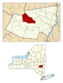
Location in Greene County and the state of New York
-
Union Chapel in Windham
See also
 In Spanish: Windham (Nueva York) para niños
