
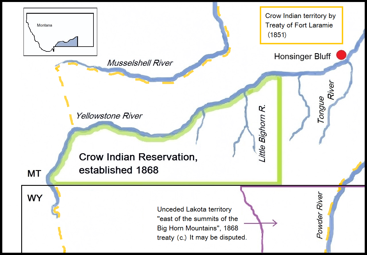
Image: Map with the Battlefield of Honsinger Bluff (1873). The lines for the unceded Lakota land east of the Bighorn Mts. may be disputed
Size of this preview: 800 × 558 pixels. Other resolutions: 320 × 223 pixels | 1,280 × 892 pixels.
Original image (1,280 × 892 pixels, file size: 575 KB, MIME type: image/png)
Description: Map with the Battlefield of Honsinger Bluff (1873) in Montana and relevant Indian territories.
Title: Map with the Battlefield of Honsinger Bluff (1873). The lines for the unceded Lakota land east of the Bighorn Mts. may be disputed
Credit: Own work
Author: Naawada2016
Usage Terms: Creative Commons Attribution-Share Alike 4.0
License: CC BY-SA 4.0
License Link: https://creativecommons.org/licenses/by-sa/4.0
Attribution Required?: Yes
Image usage
The following page links to this image:

All content from Kiddle encyclopedia articles (including the article images and facts) can be freely used under Attribution-ShareAlike license, unless stated otherwise.
._The_lines_for_the_unceded_Lakota_land_east_of_the_Bighorn_Mts._may_be_disputed.png)