
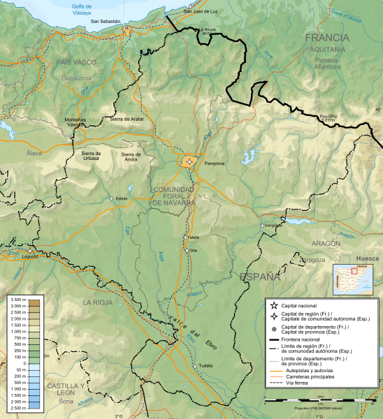
Image: Mapa físico de Navarra

Description: Topographic map of the Navarre
Title: Mapa físico de Navarra
Credit: Extract from Pyrenees topographic map-fr.svg and Pyrenees map shaded relief-fr.svg by Sting. Topographic data : NASA Shuttle Radar Topography Mission (SRTM3 v.2) (public domain) edited with 3DEM and dlgv32 Pro and vectorized with Inkscape UTM projection ; WGS84 datum Shaded relief (composite image of N-W, W and N lightning positions) Bathymetry : USGov public domain data provided by Demis (see the approval e-mail and the Demis forum) References used for the additional data : ViaMichelin Mapa localización : Provincias de España.svg, by Usuario:Tony RotondasEscalas aproximadas :Topographic data : 1:400,000 (accuracy : about 100 m) Bathymetry : 1:4 000 000 (accuracy : about 1,000 m)Note : The shaded relief is a raster image embedded in the SVG file.
Author: Miguillen(Translated into Spanish and map political boundaries); author of the original map : Bourrichon Eric Gaba (Sting - fr:Sting)
Usage Terms: Creative Commons Attribution-Share Alike 4.0
License: CC BY-SA 4.0
License Link: https://creativecommons.org/licenses/by-sa/4.0
Attribution Required?: Yes
Image usage
The following page links to this image:
