
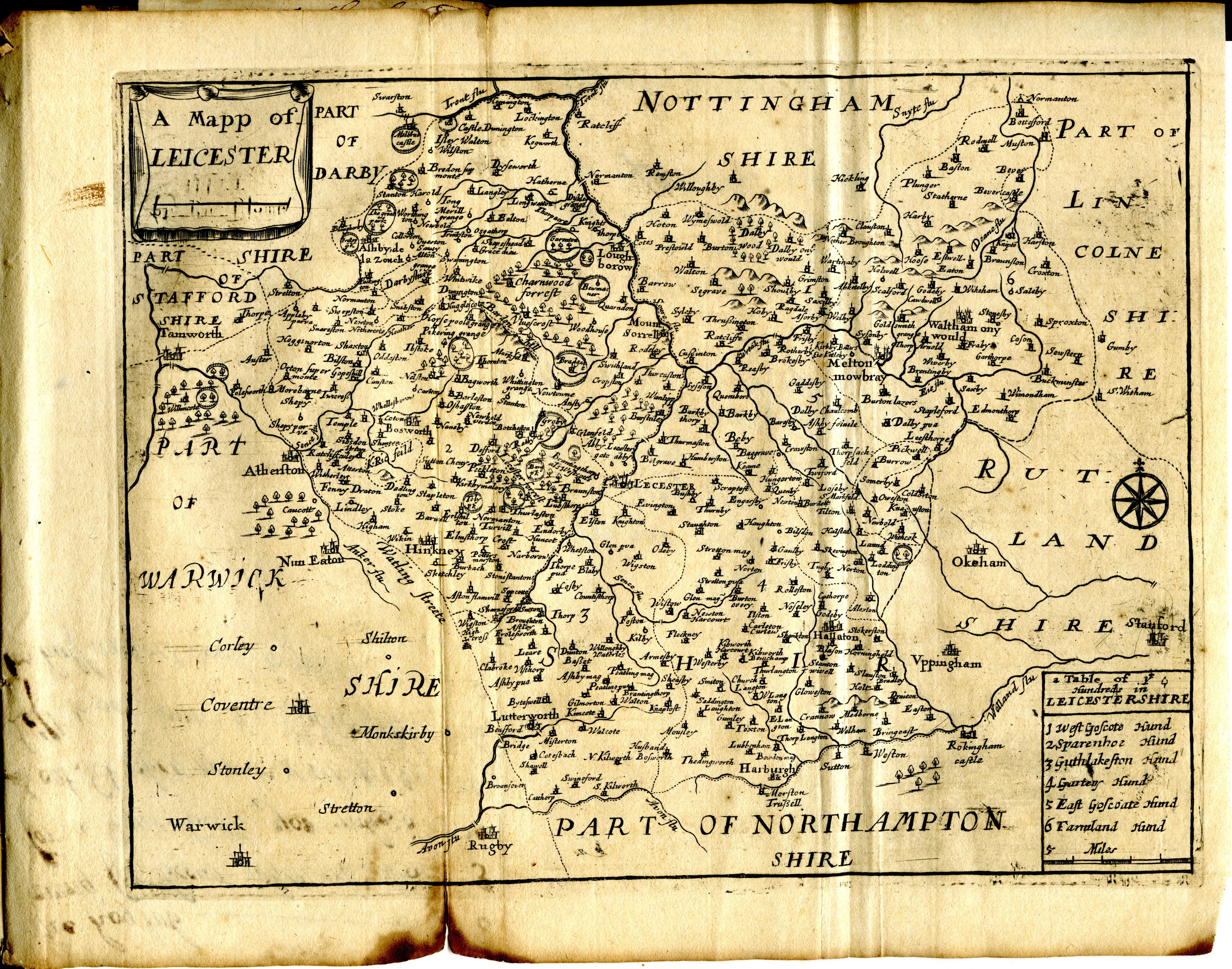
Image: Maps of England circa 1670, Leicester 22 of 40 (13432928824)
Description: 38 old maps of England folded and bound in a leather book. Most seem to have been printed from copper plates made by Richard Blome in the 1660s and 1670s. The plates were modified and Bloom's name was removed from many of the plates before this set of maps was printed at a later date. Most of the plates measured 9 x 7-1/2 inches. Book was found in New Jersey, USA. Please note that I know nothing about old maps. The backs of the maps was used as a notebook/ledger in 1726. I have posted some images of the ledger. Some of the names and dates found on these maps are: Richard Blome W. Hollar secit R. P. sculp Richard Palmer 1667 1670 1671 1672 Right click on the image and select "original" to see a high resolution image. Update: This appears to be "England Exactly Described" published by Thomas Taylor in 1715. From: www.llgc.org.uk/index.php?id=thomastayloratlas5210 "Taylor was also responsible for the publication of several maps including England exactly described [...] in 1715 containing maps of the English counties which had been issued previously in Speed's Maps Epitomiz'd in 1681 and in other works. "
Title: Maps of England circa 1670, Leicester 22 of 40 (13432928824)
Credit: Maps of England circa 1670, Leicester 22 of 40
Author: Richard from USA
Usage Terms: Creative Commons Attribution 2.0
License: CC BY 2.0
License Link: https://creativecommons.org/licenses/by/2.0
Attribution Required?: Yes
Image usage
The following page links to this image:

.jpg)