History of Leicestershire facts for kids
This article explores the exciting history of Leicestershire, a county in England. You'll learn about its ancient roads, how its borders changed, and the people who lived here long ago.
Contents
Where is Leicestershire? (Geography and Name)
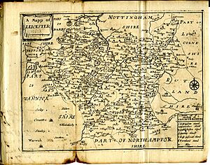
The name Leicestershire first appeared in records around 1087. In a very old book called the Domesday Book from 1087, it was written as Ledecestrescire.
Leicestershire's borders haven't changed much since that time. A small part of Derbyshire was swapped for an area called Netherseal/Overseal. Also, as Market Harborough grew, a nearby village called Little Bowden joined Leicestershire.
Old Divisions: Hundreds
In 1086, the Domesday Book showed Leicestershire divided into areas called wapentakes. These were like early districts. There were four main ones: Guthlaxton, Framland, Goscote, and Gartree.
Later, these wapentakes became known as hundreds. Goscote split into West Goscote and East Goscote. Sparkenhoe hundred was also created from part of Guthlaxton.
Ancient Paths and Roads
Prehistoric Tracks
Before the 10th century, not many people lived in Leicestershire. So, there aren't many old paths left from that time. One very old path, called the "Jurassic Trackway," connected southern England to northern England. It likely crossed Leicestershire around Husbands Bosworth and Tilton. This path was probably used as early as the Bronze Age (about 1900-1000 BC).
Another ancient road came from the Fens (a marshy area) and crossed the county. It went near Croxton Kerrial and Saltby. It might have continued into Charnwood Forest, as Beacon Hill was a Bronze Age site.
An old east-to-west road linked the River Welland and the River Trent. It started near Stamford and went through high ground near Buckminster. This road was used in the Bronze Age or early Iron Age. It stayed important through Roman and early Anglo-Saxon times.
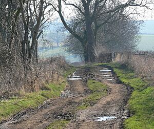
Sewstern Lane was another old road, used throughout the Middle Ages. It was a direct route between big fairs in Nottingham and Stamford. Later, coaches used a different route. Sewstern Lane then became a "drove road" for moving cattle until railways took over.
Other very old paths met near Tilton. One, called Ridgemere Lane, runs north of Cold Newton. Another goes near Lowesby and South Croxton. We don't know exactly when these were made, but they are older than Roman times.
A very old road, possibly from the Bronze Age, came from Stamford. It followed a ridge through places like Edith Weston and Martinsthorpe. It entered Leicestershire near Withcote and went through Halstead to Tilton. From Tilton, it continued west towards Leicester. This path was used by merchants in the Middle Ages to reach fairs in Stamford.
Roman Roads
Leicestershire has about 76 miles of Roman roads. These are clearly marked on maps today. One famous Roman road, Watling Street, forms part of the county's border with Warwickshire.
The longest Roman road stretch here goes from High Cross to the old Roman town of Vernemetum. This road passes through Leicester and is part of the Fosse Way. The Fosse Way was built around 46-48 AD. The section north of Leicester is now the main road to Newark. Watling Street was built a bit later, around 50-51 AD.
Medieval Roads and Bridges
The Anglo-Saxons didn't build many new roads. Instead, they used and improved the paths that connected their villages. Many of today's roads follow these old Anglo-Saxon routes. Some old grassy paths, called "The Mere" (meaning boundary), still exist and follow parish borders.
In the 1200s and 1300s, many villages started holding fairs and markets. This made some villages grow into market towns. Roads became more important for connecting these towns. Bridges were also built to help people cross rivers.
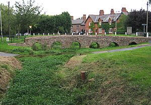
Most medieval bridges in the county were built in the late 1200s or early 1300s. None of these very early stone bridges are still standing. However, some later ones from the 1400s or later can still be seen at Aylestone, Anstey, Enderby Mill, and Rearsby.
Changes to County Status
In 1974, a law changed how local government worked. The nearby county of Rutland became a district within Leicestershire. Also, Leicester City, which used to be its own special area, became a district of Leicestershire too.
However, these changes were reversed in 1997. Rutland and the City of Leicester became independent again. Rutland is now its own ceremonial county, but the police force for both areas is still Leicestershire Constabulary.
Early History
Leicestershire has many old earthworks. These include hill-top forts from the 1st century BC and sites of villages that were abandoned in the Middle Ages. You can find hill-forts, Roman camps (like Ratby), and old castle sites (like Hallaton). There are also places where old villages used to be, such as Ingarsby.
The county was not very populated until the 900s AD. Much of it was thick forests and heavy clay land. But during the Middle Ages, people cleared the land and settled more. This made the county more populated and wealthy, especially in the eastern and southeastern parts.
Long ago, the area of Leicestershire was home to an ancient British tribe called the Corieltauvi. After the Romans conquered Britain, this area became part of a Roman province.
In Anglo-Saxon times, the land was settled by the Middle Angles. Their territory later became part of the kingdom of Mercia. Later, the kings of Wessex also ruled Mercia. The kingdom was divided into shires (counties) around 800 AD or earlier.
When the Danes invaded, the Midlands were often attacked. After the Danish invasions, Leicestershire became part of the Danelaw. This was an area ruled by Danish laws.
Religious History: The Diocese
A bishopric (an area led by a bishop) for the Middle Angles was set up here in 680 AD. The Anglo-Saxon cathedral was probably near where the current Leicester Cathedral stands. This early diocese was affected by the Danish invasion around 870 AD. After the Danelaw was established, the bishop's seat moved to Oxfordshire. It then became the Mercian Diocese of Dorchester.
20th Century Religious Changes
After 1541, Leicestershire was part of the Diocese of Peterborough. In the 1800s, there were special bishops for Leicester, even though it was still part of Peterborough.
The modern Diocese of Leicester was officially created on November 12, 1926. It was formed from parts of the Peterborough Diocese. St Martin's Church in Leicester became the main church for this new diocese.
County Symbol
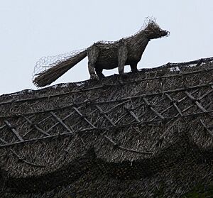
The symbol for Leicestershire is the red fox. You can see it on the county council's crest and on the emblems of sports teams like Leicestershire County Cricket Club and Leicester City FC.
Leicestershire is famous for being the birthplace of modern fox hunting. Hugo Meynell of Quorn, who led the Quorn Hunt from 1753 to 1800, is known as the "father of fox hunting." Towns like Melton Mowbray and Market Harborough are also linked to this tradition.
See also
- History of England
- Corieltauvi
- Five Burghs
- Diocese of Leicester
- House of Beaumont
- Leir of Britain
- List of lost settlements in the United Kingdom#Leicestershire
- List of hundreds of England and Wales#Leicestershire
 | Aaron Henry |
 | T. R. M. Howard |
 | Jesse Jackson |


