
Image: Maria 2017-09-20 0238Z (Coastline-less)
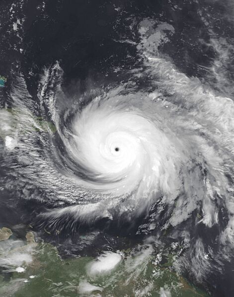
Description: This infrared composite representation of Hurricane Maria was captured during the night of September 19, 2017, at 10:38 P.M. Puerto Rico Local Time (02:38 UTC on September 20), employing the Moderate Resolution Imaging Spectroradiometer (MODIS) instrument aboard the polar orbiting Terra satellite launched by NASA in December 1999, the satellite and its instrumentation serve to monitor meteorological phenomena like Maria. Hurricane Maria, a formidable and expansive cyclone, emerged from an invest area within the primary development zone of the Atlantic Ocean during the 2017 Atlantic hurricane season. At the time of imaging, the storm exhibited peak intensity strength, boasting maximum sustained winds of 175 mph (282 km/h) (150 knots) on the 1-minute Saffir-Simpson scale, classifying it as an extraordinarily powerful Category 5 major hurricane. Its minimum central pressure hovered at 908 mbar (26.8 inHg), Maria proceeded to devastate Puerto Rico, resulting in 2,975 fatalities (3,059 total fatalities including other islands and surrounding nations) and causing $91.6 billion in damages. This places it as the fourth (third at the time) most expensive tropical cyclone in history, following behind Katrina in 2005, Harvey earlier in the same season, and Ian which occurred five years later in 2022.
Usage Terms: Public domain
Image usage
The following page links to this image:

.jpg)